IMAGES TAKEN NEAR TO
Berryhill Road, GLASGOW, G67 1LY
Introduction
This page details the photographs taken nearby to Berryhill Road, G67 1LY by members of the Geograph project.
The Geograph project started in 2005 with the aim of publishing, organising and preserving representative images for every square kilometre of Great Britain, Ireland and the Isle of Man.

There are currently over 7.5m images from over14,400 individuals and you can help contribute to the project by visiting https://www.geograph.org.uk
Image Map
Images are licensed for reuse under creativecommons.org/licenses/by-sa/2.0
Notes
- Clicking on the map will re-center to the selected point.
- The higher the marker number, the further away the image location is from the centre of the postcode.
Image Listing (9 Images Found)
Images are licensed for reuse under creativecommons.org/licenses/by-sa/2.0
Image
Details
Distance
2
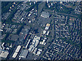
Cumbernauld town centre from the air
Viewed from a Prague bound flight from Glasgow.
Image: © Thomas Nugent
Taken: 5 Jun 2016
0.18 miles
3
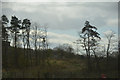
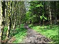
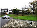
North Lanarkshire : Grassy Area
An area with some trees and grass.
Image: © Lewis Clarke
Taken: 25 Apr 2016
0.21 miles
6
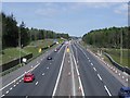
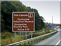
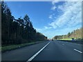
Cumbernauld, M80 motorway
Opened September 2011 and repairs required eight months later ......
View to north-east.
Image: © Robert Murray
Taken: 20 May 2012
0.23 miles
8
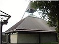
St Mungo's Church, Cumbernauld
St Mungo's Church is very Modernist, however, it is not as unpopular as its neighbour, the infamous Cumbernauld Town Centre!
Image: © GaryReggae
Taken: 25 Sep 2006
0.24 miles
9

Cumbernauld, M80 footbridge
This recently refurbished structure allows foot traffic between east and west (or north and south) of the Cumbernauld suburbs of Balloch/Eastfield and Ravenswood/Seafar.
This bridge is also probably the narrowest choke point on the watershed walk of Scotland between Peel Fell on the English border and the north coast destinations of Cape Wrath and/or Dunnet Head. So if you fancy doing that marathon hike - which only 3 or 4 pioneers have done before, you will cross this bridge.
Image: © Robert Murray
Taken: 20 May 2012
0.25 miles