1
Glazert Water, Milton of Campsie
Image: © Iain Thompson
Taken: 28 Jun 2006
0.04 miles
2
Milton of Campsie Station
Now part of the route of the Strathkelvin Railway Path, this was once a station on the Campsie Branch (Edinburgh and Glasgow Railway) which opened in 1848 and finally closed in 1966.
Image: © Richard Sutcliffe
Taken: 19 Nov 2020
0.05 miles
3
Milton of Campsie Station
Now part of the route of the Strathkelvin Railway Path, this was once a station on the Campsie Branch (Edinburgh and Glasgow Railway) which opened in 1848 and finally closed in 1966.
Image: © Richard Sutcliffe
Taken: 19 Nov 2020
0.05 miles
4
Cycleway in Milton of Campsie
Image: © Iain Thompson
Taken: 28 Jun 2006
0.06 miles
5
Infilled bridge, Milton of Campsie
Path saved by a tunnel, may be a solution to the problem in England where bridges on potential rails to trails conversions are being blocked. This is the site of Milton of Campsie Station, closed to passengers in 1951.
Image: © Richard Webb
Taken: 26 Jan 2023
0.09 miles
6
Milton of Campsie Station
The bridge has been partly filled and now a pipe takes the Strathkelvin walkway, a cycle/foot path through the arch. There were platforms (still there) on both sides of the B757 bridge.
Image: © Richard Webb
Taken: 1 Jun 2012
0.09 miles
7
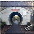
Cycleway in Milton of Campsie
Cycleway from Kirkintilloch to Strathblane following the route of a dismantled railway.
Image: © Iain Thompson
Taken: 28 Jun 2006
0.09 miles
8
Bridge over the old railway line
The bridge carries Birdston Road over the line of the former Campsie Branch (Edinburgh and Glasgow Railway) which opened in 1848 and closed in 1966. The bridge crosses over the former Milton of Campsie Station. Part of the arch of the bridge has been infilled and the Strathkelvin Railway Path now runs through a large pipe. The platforms used to continue under the bridge, and one can be seen on the far side of the opening to the left of the figure.
Image: © Richard Sutcliffe
Taken: 19 Nov 2020
0.09 miles
9
Birdston Road, Milton of Campsie
Image: © Richard Sutcliffe
Taken: 19 Nov 2020
0.10 miles
10
Birdston Road, Milton of Campsie
Image: © Richard Sutcliffe
Taken: 14 Jul 2019
0.10 miles


