
IMAGES TAKEN NEAR TO
Valleyfield, GLASGOW, G66 8HN
Introduction
This page details the photographs taken nearby to Valleyfield, G66 8HN by members of the Geograph project.
The Geograph project started in 2005 with the aim of publishing, organising and preserving representative images for every square kilometre of Great Britain, Ireland and the Isle of Man.

There are currently over 7.5m images from over14,400 individuals and you can help contribute to the project by visiting https://www.geograph.org.uk
Image Map
Images are licensed for reuse under creativecommons.org/licenses/by-sa/2.0
Notes
- Clicking on the map will re-center to the selected point.
- The higher the marker number, the further away the image location is from the centre of the postcode.
Image Listing (23 Images Found)
Images are licensed for reuse under creativecommons.org/licenses/by-sa/2.0
Image
Details
Distance
1
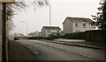
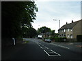
Looking along the A891
The houses are on Valleyfield, a cul-de-sac to the south of the main road.
Image: © Richard Sutcliffe
Taken: 1 Dec 2019
0.03 miles
2
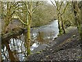
Glazert Water
Looking downstream from beside the bridge carrying the Strathkelvin Railway Path over the river.
Image: © Richard Sutcliffe
Taken: 28 Jan 2023
0.06 miles
3
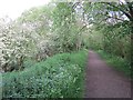
Blane Valley Railway
The path on the trackbed runs beside the Glazert Water. It was popular with fishermen today.
Image: © Richard Webb
Taken: 1 Jun 2012
0.07 miles
4
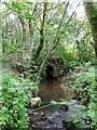
Culvert under old railway, Milton of Campsie
An unnamed burn flowing from the direction of Barrhill (west of the B822) passes under the modern walkway before emptying into the glazert a few feet behind the foreground pictured.
Image: © Robert Murray
Taken: 25 Aug 2010
0.08 miles
6
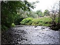
Glazert Water, Milton of Campsie
Woodland on the south with the village to the north.
Image: © Robert Murray
Taken: 25 Aug 2010
0.09 miles
7
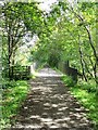
Bridge over the Glazert
Takes the walkway from Lennoxtown to Milton of Campsie and Kirkintilloch over the refurbished railway bridge following the old line.
Image: © Robert Murray
Taken: 25 Aug 2010
0.11 miles
8
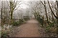
Bridge over the Glazert Water
The path is the Strathkelvin Railway Path, which follows the line of the old railway line that runs from Gartcosh to Strathblane. This section is part of the former Blane Valley Railway which opened in 1866 and finally closed in 1966.
Seen on a frosty December day.
Image: © Richard Sutcliffe
Taken: 1 Dec 2019
0.11 miles
9
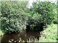
Bridge over the Glazert
A new concrete structure laid on the old steel girders. No trains cross the river here now only walkers, joggers and cyclists.
Image: © Robert Murray
Taken: 25 Aug 2010
0.12 miles
10
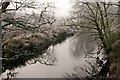
Glazert Water
Seen from the Strathkelvin Railway Path where it crossed the river.
Image: © Richard Sutcliffe
Taken: 1 Dec 2019
0.13 miles