IMAGES TAKEN NEAR TO
Lochaber Walk, GLASGOW, G66 8ES
Introduction
This page details the photographs taken nearby to Lochaber Walk, G66 8ES by members of the Geograph project.
The Geograph project started in 2005 with the aim of publishing, organising and preserving representative images for every square kilometre of Great Britain, Ireland and the Isle of Man.

There are currently over 7.5m images from over14,400 individuals and you can help contribute to the project by visiting https://www.geograph.org.uk
Image Map
Images are licensed for reuse under creativecommons.org/licenses/by-sa/2.0
Notes
- Clicking on the map will re-center to the selected point.
- The higher the marker number, the further away the image location is from the centre of the postcode.
Image Listing (60 Images Found)
Images are licensed for reuse under creativecommons.org/licenses/by-sa/2.0
Image
Details
Distance
1
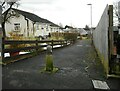
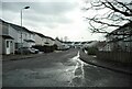
Footpath from Lochalsh Crescent
Leading to Lochiel Drive.
Image: © Richard Sutcliffe
Taken: 25 Feb 2022
0.01 miles
3
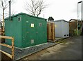
Gas and electricity substations
Baldoran DG gas installation and Scottish Power's Lochiel Drive substation. Beside a footpath and steps from Lochiel Drive to Craighead Road.
Image: © Richard Sutcliffe
Taken: 25 Feb 2022
0.04 miles
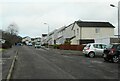
5
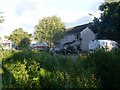
Town meets country
The end of Lochalsh Crescent in Milton of Campsie.
Image: © Stephen Sweeney
Taken: 12 Aug 2010
0.06 miles
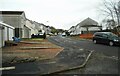
7
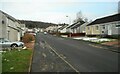
Milton of Campsie, private road
A back lane that leads to Shiels farm and the braes of the Campsies.
Image: © Robert Murray
Taken: 13 Jul 2010
0.08 miles
8

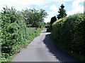
Road and path beside the Brash Burn
The footpath on the right runs from Lochiel Drive to Lochalsh Crescent. The road on the left leads to Baldoran Farm, but in Victorian times it was also the line of a tramway which linked the former Glorat Lime Works (about 300m north) to the Blane Valley Railway just south of the Glazert Water.
Image: © Richard Sutcliffe
Taken: 25 Feb 2022
0.09 miles
10
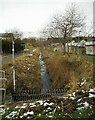
The Brash Burn
It disappears under the feet of the photographer Image
Image: © Richard Sutcliffe
Taken: 25 Feb 2022
0.10 miles