IMAGES TAKEN NEAR TO
Lennoxtown, GLASGOW, G66 7NP
Introduction
This page details the photographs taken nearby to G66 7NP by members of the Geograph project.
The Geograph project started in 2005 with the aim of publishing, organising and preserving representative images for every square kilometre of Great Britain, Ireland and the Isle of Man.

There are currently over 7.5m images from over14,400 individuals and you can help contribute to the project by visiting https://www.geograph.org.uk
Image Map
Images are licensed for reuse under creativecommons.org/licenses/by-sa/2.0
Notes
- Clicking on the map will re-center to the selected point.
- The higher the marker number, the further away the image location is from the centre of the postcode.
Image Listing (24 Images Found)
Images are licensed for reuse under creativecommons.org/licenses/by-sa/2.0
Image
Details
Distance
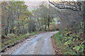
2
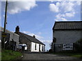
Road to Lennoxtown
Just east of Muirhead Farm.
Image: © Stephen Sweeney
Taken: 1 Jul 2011
0.07 miles
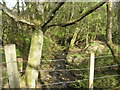
3
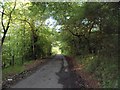
Right of Way to Torrance
Adjacent to Muirhead Farm.
Image: © Robert Murray
Taken: 9 Jul 2015
0.08 miles
4
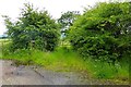
![Path to Torrance [2]](https://s0.geograph.org.uk/geophotos/04/56/94/4569448_7cd2c104_120x120.jpg)
Path to Torrance [2]
Downhill all the way at this point.
Image: © Robert Murray
Taken: 9 Jul 2015
0.09 miles
5
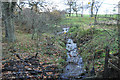
Burn through Finniescroft Wood, near Lennoxtown
Image: © Chris Upson
Taken: 5 May 2006
0.09 miles
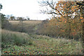
7

Field west of Muirhead Farm
Overlooking Glasgow.
Image: © Stephen Sweeney
Taken: 1 Jul 2011
0.12 miles
9
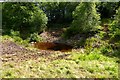
Cattle Pond
Small stream has been dammed to create a water supply for the kai.
Image: © Robert Murray
Taken: 15 Jul 2015
0.13 miles