
IMAGES TAKEN NEAR TO
Campsie Glen, GLASGOW, G66 7AS
Introduction
This page details the photographs taken nearby to G66 7AS by members of the Geograph project.
The Geograph project started in 2005 with the aim of publishing, organising and preserving representative images for every square kilometre of Great Britain, Ireland and the Isle of Man.

There are currently over 7.5m images from over14,400 individuals and you can help contribute to the project by visiting https://www.geograph.org.uk
Image Map
Images are licensed for reuse under creativecommons.org/licenses/by-sa/2.0
Notes
- Clicking on the map will re-center to the selected point.
- The higher the marker number, the further away the image location is from the centre of the postcode.
Image Listing (32 Images Found)
Images are licensed for reuse under creativecommons.org/licenses/by-sa/2.0
Image
Details
Distance
1

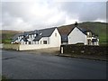
Balcorrach & a view to the Campsie Fells
Image: © Leslie Barrie
Taken: 21 Sep 2008
0.01 miles
3
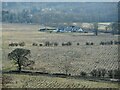
Balcorrach
The group of buildings consists of 1-4 Balcorrach Cottages; Balcorrach Farm and Byre.
There has been planting of new woodland in the foreground.
Image: © Richard Sutcliffe
Taken: 24 Mar 2022
0.04 miles
4
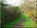
Balcorrach, riverside path
Path from Lennoxtown to Haughhead alongside the Kirk Burn.
Image: © Robert Murray
Taken: 1 Nov 2011
0.06 miles
5
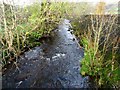
Balcorrach, Kirk Burn
Follows straight line of the adjacent A891 road
Image: © Robert Murray
Taken: 1 Nov 2011
0.06 miles
6
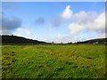
Haughhead
The 'Haugh' at Haughhead, particularly the area of floodplain lying between the Finglen and Kirk burns.
Image: © Robert Murray
Taken: 1 Nov 2011
0.09 miles
7
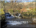
Weir on the Kirk Burn
The Kirk Burn runs parallel to the A891 near Haughhead
Image: © Duncan Gray
Taken: 15 Feb 2012
0.13 miles
8
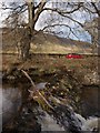
Kirk Burn weir
Walkers can follow a track along the Kirk Burn between Lennoxtown and Haughhead. This picture looks from this path across the weir to the A891 with the escarpment of the Campsies behind. The weir is also shown in Image
Image: © Alec MacKinnon
Taken: 28 Apr 2013
0.13 miles
9
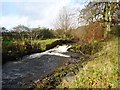
Haughhead, Kirk Burn weir
A lade took off from above the weir going under the road to a mill pond at nearby Balcorrach.
Image: © Robert Murray
Taken: 1 Nov 2011
0.13 miles
10
![Haughhead [2]](https://s0.geograph.org.uk/geophotos/02/67/73/2677316_cf89a9e1_120x120.jpg)
Haughhead [2]
Another view of the Haugh with the hamlet of the same name lying on the northern boundary.
Image: © Robert Murray
Taken: 1 Nov 2011
0.15 miles