IMAGES TAKEN NEAR TO
Kirkintilloch, GLASGOW, G66 4TA
Introduction
This page details the photographs taken nearby to G66 4TA by members of the Geograph project.
The Geograph project started in 2005 with the aim of publishing, organising and preserving representative images for every square kilometre of Great Britain, Ireland and the Isle of Man.

There are currently over 7.5m images from over14,400 individuals and you can help contribute to the project by visiting https://www.geograph.org.uk
Image Map
Images are licensed for reuse under creativecommons.org/licenses/by-sa/2.0
Notes
- Clicking on the map will re-center to the selected point.
- The higher the marker number, the further away the image location is from the centre of the postcode.
Image Listing (6 Images Found)
Images are licensed for reuse under creativecommons.org/licenses/by-sa/2.0
Image
Details
Distance
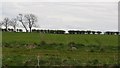
1

Meiklehill Farm
Photo taken from the approximate site of the Roman Antonine Wall (AD 140).
Image: © Robert Murray
Taken: 15 Jul 2015
0.02 miles
2
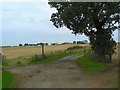
Tree by the farm road
Meiklehill Farm in the distance.
Image: © James Allan
Taken: 18 Sep 2009
0.17 miles
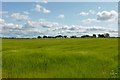
4
View to Lenzie from Crosshill Road
View eastwards.
Image: © Stephen Sweeney
Taken: 4 Sep 2009
0.19 miles
5
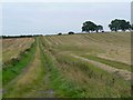
Track between fields
Near Meiklehill Farm.
Image: © James Allan
Taken: 18 Sep 2009
0.22 miles
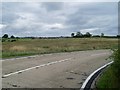
6
Arable land, Meiklehill
A view across the Forth and Clyde Canal.
Image: © Richard Webb
Taken: 9 May 2012
0.25 miles