IMAGES TAKEN NEAR TO
Kilsyth, GLASGOW, G65 0SA
Introduction
This page details the photographs taken nearby to G65 0SA by members of the Geograph project.
The Geograph project started in 2005 with the aim of publishing, organising and preserving representative images for every square kilometre of Great Britain, Ireland and the Isle of Man.

There are currently over 7.5m images from over14,400 individuals and you can help contribute to the project by visiting https://www.geograph.org.uk
Image Map
Images are licensed for reuse under creativecommons.org/licenses/by-sa/2.0
Notes
- Clicking on the map will re-center to the selected point.
- The higher the marker number, the further away the image location is from the centre of the postcode.
Image Listing (14 Images Found)
Images are licensed for reuse under creativecommons.org/licenses/by-sa/2.0
Image
Details
Distance
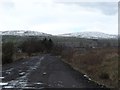
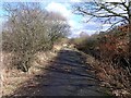
2
Path, Auchinvole
Reclaimed land, now wooded.
Image: © Richard Webb
Taken: 30 Sep 2011
0.17 miles
3
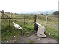
Dumper attack near Strone Point
When you struggle to find a parking space for a walk, remember in some places if there is a place off the road, it encourages vermin. If the road is quiet enough they will use that.
Image: © Richard Webb
Taken: 30 Sep 2011
0.18 miles
4
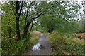
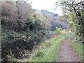
The River Kelvin Walkway from Auchinstarry to Twechar
The walkway follows an old mineral railway line.
Image: © Tim Heaton
Taken: 9 Oct 2018
0.21 miles
5
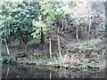
Forth and Clyde Canal
Near Strone Point.
Image: © Richard Webb
Taken: 30 Sep 2011
0.21 miles
6
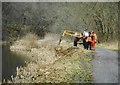
Canal maintenance
Scottish Canals staff doing maintenance along the bank of the Forth and Clyde Canal.
Image: © Richard Sutcliffe
Taken: 9 Mar 2020
0.21 miles
7
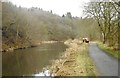
Forth and Clyde Canal
The woods on Bar Hill, beside the Forth and Clyde canal.
Image: © Richard Webb
Taken: 30 Sep 2011
0.22 miles
8
Canal maintenance
Scottish Canals staff doing maintenance along the bank of the Forth and Clyde Canal.
Image: © Richard Sutcliffe
Taken: 9 Mar 2020
0.22 miles
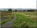
9
Woodland track, Dumbreck Marsh
This track follows the line of the Garrel Burn.
Image: © Robert Murray
Taken: 12 Feb 2010
0.23 miles
10
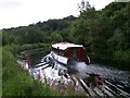
Canal boat
This craft was once a common sight on this canal, nice to see their revival.
Image: © Linda Watt
Taken: 24 Aug 2008
0.23 miles