IMAGES TAKEN NEAR TO
Stirling Road, GLASGOW, G65 0HX

Introduction

This page details the photographs taken nearby to Stirling Road, G65 0HX by members of the Geograph project.

The Geograph project started in 2005 with the aim of publishing, organising and preserving representative images for every square kilometre of Great Britain, Ireland and the Isle of Man.

There are currently over 7.5m images from over14,400 individuals and you can help contribute to the project by visiting https://www.geograph.org.uk

Image Map


Images are licensed for reuse under creativecommons.org/licenses/by-sa/2.0
Notes
  • Clicking on the map will re-center to the selected point.
  • The higher the marker number, the further away the image location is from the centre of the postcode.

Image Listing (86 Images Found)

Images are licensed for reuse under creativecommons.org/licenses/by-sa/2.0
  • ...
Image
Details
Distance
1
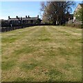
Putting Green: Burngreen Park
Looks like any open grassy area but there were pins marking the holes
Image: © Jim Smillie Taken: 22 Apr 2022
0.05 miles
2
Recreation ground
A red blaes pitch beside Burngreen Community Centre.
Image: © Richard Sutcliffe Taken: 31 Mar 2022
0.05 miles
3
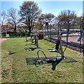
Outdoor Gym
In Burngreen Park Kilsyth
Image: © Jim Smillie Taken: 22 Apr 2022
0.05 miles
4
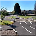
Road traffic school
According to North Lanarkshire Council's website: 'The road traffic school has been a top attraction in the park for over 50 years. It offers children between the ages of 1 and 8 the chance to use a mini road layout and develop their cycling ability and road safety skills. It includes a range of road features including traffic lights and signs, roundabouts, crossroads, pedestrian crossings and junctions. Children's bikes and safety helmets are available to hire or visitors can use their own provided the bike does not have gears.'
Image: © Richard Sutcliffe Taken: 31 Mar 2022
0.06 miles
5
Monieburgh Road, Kilsyth
Looking north.
Image: © JThomas Taken: 30 Mar 2017
0.07 miles
6
Traffic school: Burngreen Park
Rush hour has passed. Only minutes earlier this area was full of youngsters practising their bicycle skills
Image: © Jim Smillie Taken: 22 Apr 2022
0.07 miles
7
Burngreen Community Centre
Known as Burngreen Hall, it was built in 1930. Operated by North Lanarkshire Council, it is used for keep fit, local support meetings, mother and toddlers clubs, slimming clubs, local government meetings, children’s theatre classes and councillor surgeries.
Image: © Richard Sutcliffe Taken: 31 Mar 2022
0.08 miles
8
Houses on Stirling Road, Kilsyth
Showing position of Postbox No. G65 387. See Image] for postbox.
Image: © JThomas Taken: 30 Mar 2017
0.08 miles
9
Kilsyth Bowling Club coat of arms
Image: © Stevie Spiers Taken: 17 May 2009
0.08 miles
10
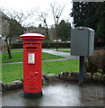
George V postbox on Stirling Road, Kilsyth
Postbox No. G65 387. See Image] for context.
Image: © JThomas Taken: 30 Mar 2017
0.09 miles
  • ...