IMAGES TAKEN NEAR TO
High Barrwood Road, GLASGOW, G65 0EG
Introduction
This page details the photographs taken nearby to High Barrwood Road, G65 0EG by members of the Geograph project.
The Geograph project started in 2005 with the aim of publishing, organising and preserving representative images for every square kilometre of Great Britain, Ireland and the Isle of Man.

There are currently over 7.5m images from over14,400 individuals and you can help contribute to the project by visiting https://www.geograph.org.uk
Image Map (15 Images)
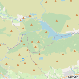
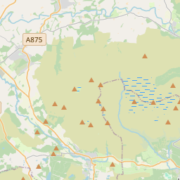

Leaflet Map data © OpenStreetMap
Images are licensed for reuse under creativecommons.org/licenses/by-sa/2.0
Notes
- Clicking on the map will re-center to the selected point.
- The higher the marker number, the further away the image location is from the centre of the postcode.
Image Listing (15 Images Found)
Images are licensed for reuse under creativecommons.org/licenses/by-sa/2.0
Image
Details
Distance
1
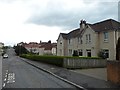
Barrwood, Kilsyth
Residential area to the east of the town.
Image: © Stephen Sweeney
Taken: 3 Apr 2012
0.11 miles
2
Kilsyth, North Barwood
The hill is called the Rocks I think.
Image: © Robert Murray
Taken: 21 Jan 2010
0.14 miles
3
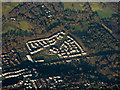
Kilsyth from the air
Looking over new houses at Cavalry Park Road towards Colzium House.
Image: © Thomas Nugent
Taken: 4 Dec 2016
0.16 miles
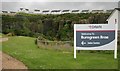
4
New houses above Barrwood Quarry, Kilsyth
Part of the Burngreen Brae development by Dawn Homes.
Image: © Richard Sutcliffe
Taken: 18 Jun 2018
0.18 miles
5
New houses above Barrwood Quarry, Kilsyth
The flooded quarry is now the centrepiece of Burngreen Brae, a residential development by Dawn Homes. For a more recent, aerial view of the development, see [https://www.geograph.org.uk/photo/6212881].
Image: © Richard Sutcliffe
Taken: 18 Jun 2018
0.18 miles
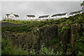
6
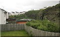
Barrwood Quarry, Kilsyth
The flooded quarry is now the centrepiece of Burngreen Brae, a residential development by Dawn Homes.
Image: © Richard Sutcliffe
Taken: 18 Jun 2018
0.18 miles
7
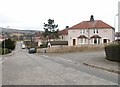
St Mirren's Rd, Kilsyth
St Mirren's Rd, Kilsyth typical housing for much of this square
Image: © Jim Bain
Taken: 26 Feb 2006
0.19 miles
8
Barrwood Quarry, Kilsyth
The flooded quarry is now the centrepiece of Burngreen Brae, a residential development by Dawn Homes. Some of the last houses are under construction.
Image: © Richard Sutcliffe
Taken: 18 Jun 2018
0.20 miles
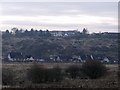
9
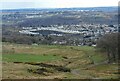
Spot the quarry
The new houses (built c. 2018) as the Burngreen Brae development stand out clearly due to the large gap in the middle where a former (water-filled) quarry remains. Viewed from the hills above Kilsyth.
Image: © Richard Sutcliffe
Taken: 31 Mar 2022
0.21 miles
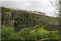
10
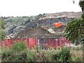
Barrwood Quarry
There is a lot of work going on in the quarry right now. Possibly landscaping associated with the neighbouring new housing development.
Image: © Richard Webb
Taken: 30 Sep 2011
0.22 miles