
IMAGES TAKEN NEAR TO
Cavalry Park, GLASGOW, G65 0AU
Introduction
This page details the photographs taken nearby to Cavalry Park, G65 0AU by members of the Geograph project.
The Geograph project started in 2005 with the aim of publishing, organising and preserving representative images for every square kilometre of Great Britain, Ireland and the Isle of Man.

There are currently over 7.5m images from over14,400 individuals and you can help contribute to the project by visiting https://www.geograph.org.uk
Image Map
Images are licensed for reuse under creativecommons.org/licenses/by-sa/2.0
Notes
- Clicking on the map will re-center to the selected point.
- The higher the marker number, the further away the image location is from the centre of the postcode.
Image Listing (48 Images Found)
Images are licensed for reuse under creativecommons.org/licenses/by-sa/2.0
Image
Details
Distance
1
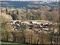
Building site, Stirling Road
Housing under construction, the view is from the Neilston Walk.
Image: © Richard Webb
Taken: 27 Jan 2012
0.06 miles
2

Footbridge over canal feeder, Colzium Estate
This would have been a demand on the canal company by the landowner as part of the wayleave.
Image: © Robert Murray
Taken: 13 Feb 2010
0.07 miles
3
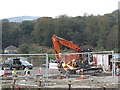
Building site, Stirling Road
New houses being built in Kilsyth.
Image: © Richard Webb
Taken: 30 Sep 2011
0.08 miles
4
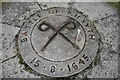
Detail of the Battle of Kilsyth monument at Colzium House Estate
The Battle of Kilsyth between the Royalists and the Covenanters took place on 15th August 1645 at nearby Banton Loch http://www.geograph.org.uk/photo/2048966. Speirs Island is the only dry part of the battle-field now remaining. It was a victory for Montrose and the Royalists. See also http://www.geograph.org.uk/photo/2177767 for another view of the monument and http://www.geograph.org.uk/photo/920648 for monument commemorating the Battle.
Image: © Becky Williamson
Taken: 13 Feb 2010
0.09 miles
5
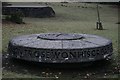
Monument commemorating the Battle of Kilsyth (1645) at Colzium House Estate
The Battle of Kilsyth between the Royalists and the Covenanters took place on 15th August 1645 at nearby Banton Loch http://www.geograph.org.uk/photo/2048966. Speirs Island is the only dry part of the battle-field now remaining. It was a victory for Montrose and the Royalists. See also http://www.geograph.org.uk/photo/2177772 for detail of the monument and http://www.geograph.org.uk/photo/920648 for another monument commemorating the Battle.
Image: © Becky Williamson
Taken: 13 Feb 2010
0.10 miles
6
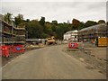
Dovecote Court (under construction)
A new development from Dawn Homes is well on the way to completion.
Image: © Texas Radio and The Big Beat
Taken: 16 Oct 2010
0.11 miles
7
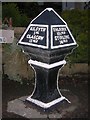
Old Milepost by the A803, east of Kilsyth
Stirling BB by the A803, in parish of Kilsyth (North Lanarkshire District), E of Kilsyth, next to Car Wash, on pavement in front of The Milestone.
Inscription reads:- : KILSYTH / 1 ML / GLASGOW / 13 MLS : : FALKIRK / 10¼ MLS / STIRLING / 14 MLS :
Surveyed
Milestone Society National ID: NL_GWFK13.
Image: © Milestone Society
Taken: Unknown
0.12 miles
8
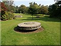
Memorial to the Duke of Montrose, Colzium Estate
This memorial sits on the Colzium Estate and commemorates the Royalist commander, James Graham, 1st Marquis of Montrose who defeated a Covenanter army led by Lieutenant-General Baillie on 15th August 1645. This was to prove to be Montrose's sixth and final victory of the Civil War in Scotland.
Image: © Euan Nelson
Taken: 11 Sep 2014
0.12 miles
9
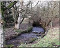
Colzium Burn
Emerging from under the canal feeder aqueduct on its way to Calvary Park and Kilsyth town.
Image: © Robert Murray
Taken: 21 Jan 2010
0.13 miles
10
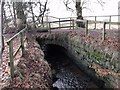
Colzium Estate bridge over canal feeder
Solid late 18th. century mason work still as good as new.
Image: © Robert Murray
Taken: 21 Jan 2010
0.13 miles