IMAGES TAKEN NEAR TO
Torrance, GLASGOW, G64 4DL
Introduction
This page details the photographs taken nearby to G64 4DL by members of the Geograph project.
The Geograph project started in 2005 with the aim of publishing, organising and preserving representative images for every square kilometre of Great Britain, Ireland and the Isle of Man.

There are currently over 7.5m images from over14,400 individuals and you can help contribute to the project by visiting https://www.geograph.org.uk
Image Map
Images are licensed for reuse under creativecommons.org/licenses/by-sa/2.0
Notes
- Clicking on the map will re-center to the selected point.
- The higher the marker number, the further away the image location is from the centre of the postcode.
Image Listing (12 Images Found)
Images are licensed for reuse under creativecommons.org/licenses/by-sa/2.0
Image
Details
Distance
1
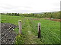
Path, Upper Carlestoun
Avoiding the farm, a nasty fenced in path. These usually turn out to be unpleasant, either muddy or overgrown with the constant risk of snagging on one of the barbed wire fences that are so close together, but this one was quite mild mannered with a hardcore surface.
Image: © Richard Webb
Taken: 31 May 2013
0.04 miles
2
Fenced in path, Upper Carlestoun
Rather narrow - watch out for the barbed wire, but well surfaced.
Image: © Richard Webb
Taken: 31 May 2013
0.06 miles
3
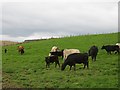
Cattle, Upper Carlestoun
Beside the newly planted Langshot Wood.
Image: © Richard Webb
Taken: 31 May 2013
0.07 miles
4
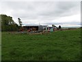
Upper Carlestoun
Construction in progress.
Image: © Richard Webb
Taken: 31 May 2013
0.08 miles
5
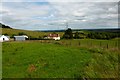
Upper Carlestoun
Bungalow adjacent to the farm.
Image: © Robert Murray
Taken: 9 Jul 2015
0.09 miles
6
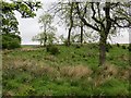
Patchy oak wood
Behind Carlestoun and beside a more substantial woodland.
Image: © Richard Webb
Taken: 31 May 2013
0.16 miles
7
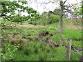
Burn behind Upper Carlestoun
Wet and infertile land as is often found on the coal measures.
Image: © Richard Webb
Taken: 31 May 2013
0.17 miles
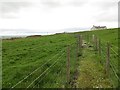
8
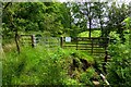
Path to Torrance, Glenwhapple
The purpose of this barrier and kissing gate escapes me as there is hardly a discernable path to speak of.
Image: © Robert Murray
Taken: 9 Jul 2015
0.17 miles
9
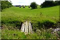
Bridge to Torrance, Glenwhapple
Upper Carleston Farm in the distance.
Image: © Robert Murray
Taken: 9 Jul 2015
0.19 miles
10
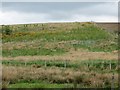
Langshot Woods
A newly planted wood on marginal farmland.
Image: © Richard Webb
Taken: 31 May 2013
0.21 miles