IMAGES TAKEN NEAR TO
Balfron Station, GLASGOW, G63 0NG
Introduction
This page details the photographs taken nearby to G63 0NG by members of the Geograph project.
The Geograph project started in 2005 with the aim of publishing, organising and preserving representative images for every square kilometre of Great Britain, Ireland and the Isle of Man.

There are currently over 7.5m images from over14,400 individuals and you can help contribute to the project by visiting https://www.geograph.org.uk
Image Map
Images are licensed for reuse under creativecommons.org/licenses/by-sa/2.0
Notes
- Clicking on the map will re-center to the selected point.
- The higher the marker number, the further away the image location is from the centre of the postcode.
Image Listing (12 Images Found)
Images are licensed for reuse under creativecommons.org/licenses/by-sa/2.0
Image
Details
Distance
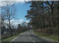
2
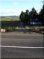
Road End at Lednabra
Road also leads to Cairnlea
Image: © Iain Thompson
Taken: 14 Apr 2006
0.05 miles
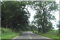
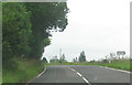
3
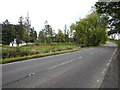
Lednabra viewed from Lay-by on the A811
Image: © James Emmans
Taken: 26 Sep 2016
0.07 miles
4
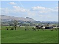
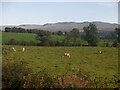
Field near Lednabra
View towards Stronend by Fintry.
Image: © Richard Webb
Taken: 29 Apr 2022
0.09 miles
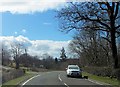
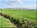
10
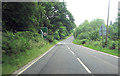
Warning for Drumhead turning
From A811 east
Image: © John Firth
Taken: 26 Jul 2012
0.23 miles