
IMAGES TAKEN NEAR TO
Balfron, GLASGOW, G63 0LR
Introduction
This page details the photographs taken nearby to G63 0LR by members of the Geograph project.
The Geograph project started in 2005 with the aim of publishing, organising and preserving representative images for every square kilometre of Great Britain, Ireland and the Isle of Man.

There are currently over 7.5m images from over14,400 individuals and you can help contribute to the project by visiting https://www.geograph.org.uk
Image Map
Images are licensed for reuse under creativecommons.org/licenses/by-sa/2.0
Notes
- Clicking on the map will re-center to the selected point.
- The higher the marker number, the further away the image location is from the centre of the postcode.
Image Listing (7 Images Found)
Images are licensed for reuse under creativecommons.org/licenses/by-sa/2.0
Image
Details
Distance
1
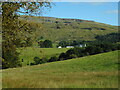
View towards Provanston Farm
The crag beyond the farm is called Skiddaw, which is on the slopes of Stronend.
Image: © Richard Sutcliffe
Taken: 26 Sep 2020
0.02 miles
2
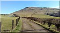
Farm track to Rashiehill
Skiddaw dominates the background of this photograph
Image: © Euan Nelson
Taken: 25 Mar 2017
0.10 miles
4
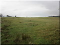
Grass field north of Provanston Farm
Image: © Jonathan Thacker
Taken: 22 Nov 2018
0.20 miles
5
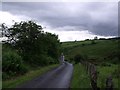
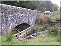
Minor road over the Lernock Burn
Runs between the B822 and Balfron.
Image: © Robert Murray
Taken: 17 Jun 2012
0.23 miles
6
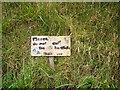
A plea
Looked like don't eat them, but is don't cut the harebells. Unusual alternative name for Campanula rotundifolia in these parts, but probably more familiar to most reading this site.
Image: © Richard Webb
Taken: 17 Sep 2006
0.23 miles
7
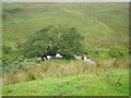
Lernock Burn
Tree lined meander where the burn drops off Balgair Muir.
Image: © Richard Webb
Taken: 17 Sep 2006
0.25 miles