IMAGES TAKEN NEAR TO
Drymen, GLASGOW, G63 0AD
Introduction
This page details the photographs taken nearby to G63 0AD by members of the Geograph project.
The Geograph project started in 2005 with the aim of publishing, organising and preserving representative images for every square kilometre of Great Britain, Ireland and the Isle of Man.

There are currently over 7.5m images from over14,400 individuals and you can help contribute to the project by visiting https://www.geograph.org.uk
Image Map
Images are licensed for reuse under creativecommons.org/licenses/by-sa/2.0
Notes
- Clicking on the map will re-center to the selected point.
- The higher the marker number, the further away the image location is from the centre of the postcode.
Image Listing (14 Images Found)
Images are licensed for reuse under creativecommons.org/licenses/by-sa/2.0
Image
Details
Distance
1
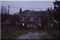
Creity Hall farm house Milton of Buchanan
Image: © Hope Childs
Taken: 26 Dec 2007
0.02 miles
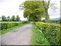
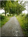
2
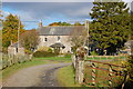
Creityhall
The West Highland Way follows a farm track passing the hall.
Image: © Trevor Harris
Taken: 24 Oct 2010
0.02 miles
4
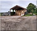
Storage shed: Creityhall Farm
Straw bales inside and plastic covered bales outside
Image: © Jim Smillie
Taken: 5 Sep 2020
0.06 miles
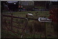
5
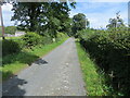
Creityhall Road (track) approaching Creityhall
Looking north-eastward. This section of track is used by the West Highland Way Path.
Image: © Peter Wood
Taken: 9 Sep 2022
0.07 miles
6
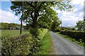
Road, Creity Hall
Heading for Garadhban Forest.
Image: © Richard Webb
Taken: 14 May 2017
0.08 miles
7
Farm track leading to Milton of Buchanan
Image: © Elliott Simpson
Taken: 17 May 2008
0.08 miles
8
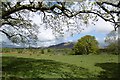
Field, Creity Hall
View towards Conic Hill.
Image: © Richard Webb
Taken: 14 May 2017
0.09 miles
9
The lower route to Balmaha
This road leads to the B837 and then into Balmaha. It is the easier route to take when walking the West Highland Way, rather than the more strenuous route via Conic Hill.
Image: © Richard Sutcliffe
Taken: 2 Aug 2020
0.11 miles
10
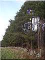
Edge of the Forest
South west tip of Garadh Ban Forest
Image: © Chris Upson
Taken: 13 Nov 2005
0.11 miles