1
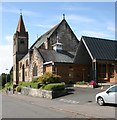
Cairns Church
Category B listed church http://portal.historicenvironment.scot/designation/LB37856, built in 1902, but with more recent additions alongside on Buchanan Street, Milngavie.
Image: © Richard Sutcliffe
Taken: 27 May 2020
0.02 miles
2
Cairns Church
Category B listed church http://portal.historicenvironment.scot/designation/LB37856, built in 1902, but with more recent additions alongside on Buchanan Street, Milngavie. Seen on a very dull Hogmanay afternoon.
Image: © Richard Sutcliffe
Taken: 31 Dec 2021
0.02 miles
3
Cairns Church
Category B listed church http://portal.historicenvironment.scot/designation/LB37856, built in 1902 on Buchanan Street, Milngavie.
Image: © Richard Sutcliffe
Taken: 27 May 2020
0.02 miles
4
Tower, Cairns Church
It looks like the church tower is a chimney, but it is not smoke but a passing wispy cloud. The church is Category B listed http://portal.historicenvironment.scot/designation/LB37856
Image
Image: © Richard Sutcliffe
Taken: 27 May 2020
0.02 miles
5
Notice board, Cairns Church
The notice board would usually have notices relating to church services etc. During the Coronavirus (Covid-19) pandemic, instead there are rainbows, showing support for the NHS. The middle notice on the left refers to the 100th birthday of Capt Tom Moore, who raised an amazing £32,796,696.73 for the NHS by walking around his garden in the lead-up to his birthday.
Image: © Richard Sutcliffe
Taken: 27 May 2020
0.03 miles
6
Church hall, Cairns Church
Beside the church on Buchanan Street, Milngavie
Image
Image: © Richard Sutcliffe
Taken: 27 May 2020
0.03 miles
7
Ladywood
A private road off Moor Road with several small blocks of flats.
Image: © Richard Sutcliffe
Taken: 27 May 2020
0.04 miles
8
Gate pillars and steps, Cairns Church
The way into the Category B listed church http://portal.historicenvironment.scot/designation/LB37856
Image from Buchanan Street.
Image: © Richard Sutcliffe
Taken: 27 May 2020
0.04 miles
9
Cairns Church, Milngavie
On the corner of Buchanan Street and Cairns Drive. This church - the present building dates back to 1903, although there has been a church on this site since 1799 - has had an interesting history, only becoming a Church of Scotland parish church in 1929 following union with the United Presbyterian Church. It was named in 1868 after the Principal of the United Presbyterian Divinity College, John Cairns.
Image: © Stephen McKay
Taken: 19 Mar 2008
0.04 miles
10
The end of Kersland Drive
The road turns to the right to give access to a lane leading down the rear of the properties on Kersland Drive. Straight on is a wide path leading on to Strathblane Road.
Image: © Richard Sutcliffe
Taken: 10 Jun 2020
0.06 miles


