IMAGES TAKEN NEAR TO
Endrick Gardens, GLASGOW, G62 7RN
Introduction
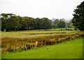
This page details the photographs taken nearby to Endrick Gardens, G62 7RN by members of the Geograph project.
The Geograph project started in 2005 with the aim of publishing, organising and preserving representative images for every square kilometre of Great Britain, Ireland and the Isle of Man.

There are currently over 7.5m images from over14,400 individuals and you can help contribute to the project by visiting https://www.geograph.org.uk
Image Map
Images are licensed for reuse under creativecommons.org/licenses/by-sa/2.0
Notes
- Clicking on the map will re-center to the selected point.
- The higher the marker number, the further away the image location is from the centre of the postcode.
Image Listing (54 Images Found)
Images are licensed for reuse under creativecommons.org/licenses/by-sa/2.0
Image
Details
Distance
1
Houses on Endrick Gardens
The houses look out onto a path and strip of grass and woodland. There is a service road behind giving access for vehicles.
Image: © Richard Sutcliffe
Taken: 9 Sep 2018
0.00 miles
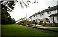
2
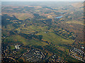
Milngavie and Strath Blane from the air
Seen shortly after taking off from Glasgow towards the north east.
Image: © Thomas Nugent
Taken: 4 Dec 2016
0.02 miles
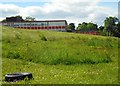
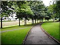
3
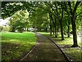
Path beside the trees
At the northern edge of Mains Estate Park.
Image: © Richard Sutcliffe
Taken: 19 Sep 2021
0.05 miles
4
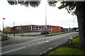
Clober Primary School
On Hunter Road.
Image: © Richard Sutcliffe
Taken: 9 Sep 2018
0.06 miles
5
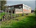
Clober Primary School
A wooden balancing activity is in the foreground.
Image: © Richard Sutcliffe
Taken: 19 Sep 2021
0.07 miles
6

Clober Primary School, Milngavie
Primary school at the corner of Hunter Road and Kirk Street in Milngavie.
Image: © G Laird
Taken: 25 Dec 2013
0.08 miles
7
Clober Primary School
Seen from Craigend Drive West.
Image: © Richard Sutcliffe
Taken: 3 Jun 2020
0.09 miles
8
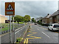
Kirk Street
Clober Primary School is on the left.
Image: © Richard Sutcliffe
Taken: 19 Sep 2021
0.10 miles
9
Footpath, Milngavie
This path runs from Hunter Road to Falloch Road. The area behind the trees is an open grassland space, known as Mains Estate Park.
Image: © Richard Sutcliffe
Taken: 9 Sep 2018
0.10 miles