IMAGES TAKEN NEAR TO
Hilton Road, GLASGOW, G62 7DN
Introduction
This page details the photographs taken nearby to Hilton Road, G62 7DN by members of the Geograph project.
The Geograph project started in 2005 with the aim of publishing, organising and preserving representative images for every square kilometre of Great Britain, Ireland and the Isle of Man.

There are currently over 7.5m images from over14,400 individuals and you can help contribute to the project by visiting https://www.geograph.org.uk
Image Map
Images are licensed for reuse under creativecommons.org/licenses/by-sa/2.0
Notes
- Clicking on the map will re-center to the selected point.
- The higher the marker number, the further away the image location is from the centre of the postcode.
Image Listing (71 Images Found)
Images are licensed for reuse under creativecommons.org/licenses/by-sa/2.0
Image
Details
Distance
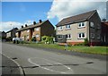
3
Graham Drive
Seen from Craigend Drive West.
Image: © Richard Sutcliffe
Taken: 3 Jun 2020
0.06 miles
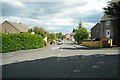
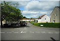
4
Craigend Crescent
Leading to Learmont Place.
Image: © Richard Sutcliffe
Taken: 3 Jun 2020
0.07 miles
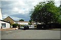
5
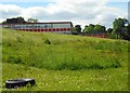
Clober Primary School
Seen from Craigend Drive West.
Image: © Richard Sutcliffe
Taken: 3 Jun 2020
0.07 miles
6
Craigend Crescent
Leading to Learmont Place.
Image: © Richard Sutcliffe
Taken: 3 Jun 2020
0.07 miles
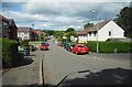
7
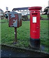
Pillar box and pouch box, Graham Drive
A Scottish cypher pillar box (postbox number G62 1325D) with a rather rusty pouch box alongside.
Image: © Richard Sutcliffe
Taken: 6 Feb 2022
0.07 miles
8
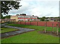
Clober Primary School
Seen from Kirk Street.
Image: © Richard Sutcliffe
Taken: 19 Sep 2021
0.08 miles
9
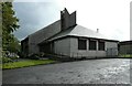
St Luke's Parish Church
Built in the 1970s.
Image: © Richard Sutcliffe
Taken: 19 Sep 2021
0.09 miles
10
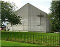
St Luke's Parish Church
Built in the 1970s.
Image: © Richard Sutcliffe
Taken: 19 Sep 2021
0.09 miles