IMAGES TAKEN NEAR TO
Breadie Drive, GLASGOW, G62 6LY
Introduction
This page details the photographs taken nearby to Breadie Drive, G62 6LY by members of the Geograph project.
The Geograph project started in 2005 with the aim of publishing, organising and preserving representative images for every square kilometre of Great Britain, Ireland and the Isle of Man.

There are currently over 7.5m images from over14,400 individuals and you can help contribute to the project by visiting https://www.geograph.org.uk
Image Map
Images are licensed for reuse under creativecommons.org/licenses/by-sa/2.0
Notes
- Clicking on the map will re-center to the selected point.
- The higher the marker number, the further away the image location is from the centre of the postcode.
Image Listing (102 Images Found)
Images are licensed for reuse under creativecommons.org/licenses/by-sa/2.0
Image
Details
Distance
1

Greenspace, Breadie Drive
The houses on Breadie Drive are arranged around the outside of a horseshoe-shaped area here. The area in between consists of grass and trees.
Image: © Richard Sutcliffe
Taken: 14 Apr 2020
0.04 miles
2
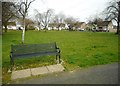
Seat beside greenspace, Breadie Drive
The houses on Breadie Drive are arranged around the outside of a horseshoe-shaped area here. The area in between consists of grass and trees.
Image: © Richard Sutcliffe
Taken: 14 Apr 2020
0.04 miles
3

Drumlin Drive, Milngavie
Looking south from Breadie Drive.
Image: © Richard Sutcliffe
Taken: 14 Apr 2020
0.04 miles
4
Corner of Breadie Drive and Shaw Road
Image: © Richard Sutcliffe
Taken: 14 Apr 2020
0.05 miles

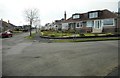
6

Breadie Drive, Milngavie
The pillar box is postbox number G62 1414.
Image: © Richard Sutcliffe
Taken: 14 Apr 2020
0.07 miles
7

Uneven road surface
Looking south along Shaw Road. The road at the junction between Nethermains Road and Shaw Road has clearly been patched many times.
Image: © Richard Sutcliffe
Taken: 14 Apr 2020
0.08 miles
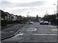
8
Keystone Quadrant
The usual speed bumps in a 20mph zone.
Image: © Richard Webb
Taken: 19 Jan 2014
0.10 miles
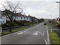
9
Drumlin Drive
Residential street on one of the many drumlins around Milngavie and Bearsden.
Image: © Richard Webb
Taken: 19 Jan 2014
0.10 miles
10
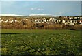
Milngavie and the Craigdhu Wedge
The houses are in Milngavie. The trees and scrub in the middle mark the Craigdhu Wedge, which follows the Craigdhu Burn. The burn is the boundary between Milngavie and Bearsden at this point.
Image: © Richard Sutcliffe
Taken: 30 Dec 2020
0.11 miles