
IMAGES TAKEN NEAR TO
Auchenhowie Road, GLASGOW, G62 6EJ
Introduction
This page details the photographs taken nearby to Auchenhowie Road, G62 6EJ by members of the Geograph project.
The Geograph project started in 2005 with the aim of publishing, organising and preserving representative images for every square kilometre of Great Britain, Ireland and the Isle of Man.

There are currently over 7.5m images from over14,400 individuals and you can help contribute to the project by visiting https://www.geograph.org.uk
Image Map
Images are licensed for reuse under creativecommons.org/licenses/by-sa/2.0
Notes
- Clicking on the map will re-center to the selected point.
- The higher the marker number, the further away the image location is from the centre of the postcode.
Image Listing (19 Images Found)
Images are licensed for reuse under creativecommons.org/licenses/by-sa/2.0
Image
Details
Distance
1
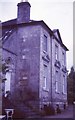
Factor's House, Dougalston
Category A listed 18th century house in what used to be Dougalston Estate.
Image: © Richard Sutcliffe
Taken: Unknown
0.01 miles
2
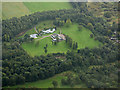
Glassford House from the air
A Category A Listed http://portal.historicenvironment.scot/designation/LB37847 former merchant's house, built in 1770 by Glasgow tobacco lord, John Glassford. Also known as the Factor's House, it sits in twenty acres of secluded gardens and woodlands near Milngavie. Later owned by the Connell shipbuilding family, it became derelict in the 1990s before being rebuilt.
Image: © Thomas Nugent
Taken: 6 Sep 2019
0.01 miles
3
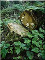
Enchanter's nightshade (Circaea lutetiana) and fungi
In woodland, Dougalston Estate.
Image: © Richard Sutcliffe
Taken: 14 Aug 2020
0.12 miles
4
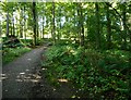
Woodland path
The path goes through the Dougalston Estate woodland.
Image: © Richard Sutcliffe
Taken: 14 Aug 2020
0.13 miles
5
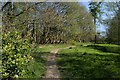
Path to the north of the Craigmaddie Burn
Image: © Richard Sutcliffe
Taken: 21 Apr 2020
0.14 miles
6
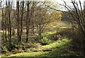
Autumn birches
The last few leaves remain on some birch trees at Dougalston.
Image: © Richard Sutcliffe
Taken: 12 Nov 2023
0.14 miles
7
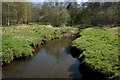
Craigmaddie Burn
The burn marks the Scottish Parliamentary Constituency boundary between Clydebank and Milngavie (on the left); and Strathkelvin and Bearsden on the right.
Image: © Richard Sutcliffe
Taken: 21 Apr 2020
0.15 miles
8
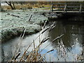
Frosted reedmace
A few seed heads of greater reedmace (Typha latifolia) covered in frost beside the Craigmaddie Burn.
Image: © Richard Sutcliffe
Taken: 2 Jan 2023
0.15 miles
9
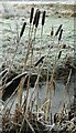
Frosted reedmace
A few seed heads of greater reedmace (Typha latifolia) covered in frost beside the Craigmaddie Burn.
Image: © Richard Sutcliffe
Taken: 2 Jan 2023
0.15 miles
10
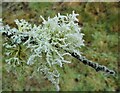
Frost-covered lichen
On a small branch of a tree beside the Craigmaddie Burn.
Image: © Richard Sutcliffe
Taken: 2 Jan 2023
0.16 miles