IMAGES TAKEN NEAR TO
Ledi Drive, GLASGOW, G61 4JL
Introduction
This page details the photographs taken nearby to Ledi Drive, G61 4JL by members of the Geograph project.
The Geograph project started in 2005 with the aim of publishing, organising and preserving representative images for every square kilometre of Great Britain, Ireland and the Isle of Man.

There are currently over 7.5m images from over14,400 individuals and you can help contribute to the project by visiting https://www.geograph.org.uk
Image Map
Images are licensed for reuse under creativecommons.org/licenses/by-sa/2.0
Notes
- Clicking on the map will re-center to the selected point.
- The higher the marker number, the further away the image location is from the centre of the postcode.
Image Listing (24 Images Found)
Images are licensed for reuse under creativecommons.org/licenses/by-sa/2.0
Image
Details
Distance
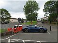
1
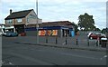
Scotmid Coop
At the corner of Ledi Drive and Duntocher Road. Cutting Edge Hair Design and Bearsden Dental Care are on the left.
Image: © Richard Sutcliffe
Taken: 28 Jul 2023
0.08 miles
2
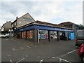
Scotmid coop, Bearsden
A local shop on the western outskirts of Bearsden, one of a small group at the junction of Ledi Drive and Duntocher Road [A810].
Image: © M J Richardson
Taken: 31 Aug 2023
0.08 miles
3
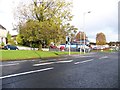
Junction of Ledi Drive and Duntochor Road
Image: © Elliott Simpson
Taken: 9 Nov 2013
0.08 miles
4
Parallel roads of Bearsden
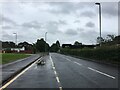
Duntocher Road [A810], on the left, runs alongside the quieter Bonnaughton Road, with a green space between. The cross road is Ledi Drive.
Image: © M J Richardson
Taken: 31 Aug 2023
0.10 miles
5
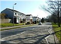
![Ledi Drive meets Duntocher Road [A810]](https://s2.geograph.org.uk/geophotos/07/59/11/7591142_2d24eaa8_120x120.jpg)
Ledi Drive meets Duntocher Road [A810]
A traffic light controlled cross roads. The houses are at the junction of Nithsdale Crescent and Castlehill Road which runs parallel with Duntocher Road.
Image: © M J Richardson
Taken: 31 Aug 2023
0.12 miles
6
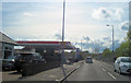
Esso garage on Duntochor Road
Opposite Farm Lane
Image: © John Firth
Taken: 12 May 2012
0.12 miles
7
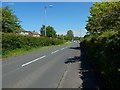
Duntocher Road
Behind the hedge on each side is a road that is parallel to this one: Bonnaughton Road on the left (north) and Castlehill Road on the right.
There is a staggered junction about 150 metres ahead.
Image: © Lairich Rig
Taken: 12 Jun 2015
0.13 miles
8
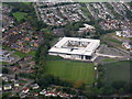
Bearsden Academy from the air
With part of St Andrew's Primary school on the left edge and, just beyond the academy, Buchanan Lodge and Care Home.
Image: © M J Richardson
Taken: 3 Oct 2015
0.15 miles
9
Grampian Way
The main street through South Baljaffray, which follows a roughly oval route through the district.
Image: © Richard Sutcliffe
Taken: 27 Mar 2022
0.15 miles