IMAGES TAKEN NEAR TO
Durness Avenue, GLASGOW, G61 2AH
Introduction
This page details the photographs taken nearby to Durness Avenue, G61 2AH by members of the Geograph project.
The Geograph project started in 2005 with the aim of publishing, organising and preserving representative images for every square kilometre of Great Britain, Ireland and the Isle of Man.

There are currently over 7.5m images from over14,400 individuals and you can help contribute to the project by visiting https://www.geograph.org.uk
Image Map
Images are licensed for reuse under creativecommons.org/licenses/by-sa/2.0
Notes
- Clicking on the map will re-center to the selected point.
- The higher the marker number, the further away the image location is from the centre of the postcode.
Image Listing (17 Images Found)
Images are licensed for reuse under creativecommons.org/licenses/by-sa/2.0
Image
Details
Distance
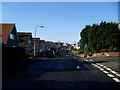
1
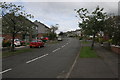
Rannoch Drive
Looking north along Rannoch Drive.
Image: © Richard Sutcliffe
Taken: 15 Sep 2015
0.04 miles
2
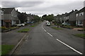
Rannoch Drive
Looking south along Rannoch Drive.
Image: © Richard Sutcliffe
Taken: 15 Sep 2015
0.08 miles
3
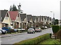
Dunkeld Drive
Gables lined up in part of a large residential area.
Image: © Richard Webb
Taken: 19 Jan 2014
0.13 miles
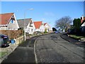
5
Methven Avenue
Residential street in Bearsden.
Image: © Stephen Sweeney
Taken: 25 Mar 2009
0.15 miles
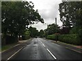
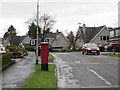
8
Ardoch Road
Residential area just off Boclair Road in Bearsden.
Image: © Stephen Sweeney
Taken: 25 Mar 2009
0.18 miles
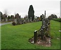
9
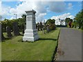
New Kilpatrick Cemetery
The white house in the right background was originally the cemetery lodge, but it is now (as a sign in front of the house reminds people) a private residence, unconnected with the cemetery.
The tall white structure just ahead, to the left, is the Galloway Memorial.
Image: © Lairich Rig
Taken: 3 Jul 2015
0.19 miles
10
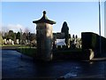
New Kilpatrick Cemetery
Cemetery on Boclair Road, behind Bearsden. New Kilpatrick was the original name for the Bearsden area.
Image: © Stephen Sweeney
Taken: 25 Mar 2009
0.20 miles