IMAGES TAKEN NEAR TO
Westfield Drive, GLASGOW, G61 1HZ
Introduction
This page details the photographs taken nearby to Westfield Drive, G61 1HZ by members of the Geograph project.
The Geograph project started in 2005 with the aim of publishing, organising and preserving representative images for every square kilometre of Great Britain, Ireland and the Isle of Man.

There are currently over 7.5m images from over14,400 individuals and you can help contribute to the project by visiting https://www.geograph.org.uk
Image Map
Images are licensed for reuse under creativecommons.org/licenses/by-sa/2.0
Notes
- Clicking on the map will re-center to the selected point.
- The higher the marker number, the further away the image location is from the centre of the postcode.
Image Listing (112 Images Found)
Images are licensed for reuse under creativecommons.org/licenses/by-sa/2.0
Image
Details
Distance
1
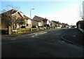
Crarae Avenue
From Westfield Drive.
Image: © Richard Sutcliffe
Taken: 9 Feb 2023
0.03 miles
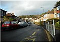
2
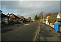
Henderland Road
The recycling bins are out.
Image: © Richard Sutcliffe
Taken: 9 Feb 2023
0.04 miles
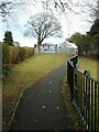
3
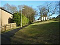
Path from Stirling Avenue to Westfield Drive
A steeper path than it looks.
Image: © Richard Sutcliffe
Taken: 9 Feb 2023
0.05 miles
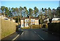
4
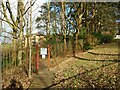
Keyholders Only
The gate gives access to a path leading up to the rear of properties at the north end of Henderland Road. Those without keys must continue up the public path behind the photographer Image via a longer route.
Image: © Richard Sutcliffe
Taken: 9 Feb 2023
0.05 miles
5
Stirling Avenue
Looking south from Monreith Avenue along Stirling Avenue.
Image: © Richard Sutcliffe
Taken: 9 Feb 2023
0.08 miles
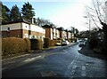
7
Houses on Stirling Avenue
Seen from Monreith Avenue.
Image: © Richard Sutcliffe
Taken: 9 Feb 2023
0.10 miles
8
Westerton Primary School
Seen from the path from Crarae Avenue to Maxwell Avenue.
Image: © Richard Sutcliffe
Taken: 9 Feb 2023
0.10 miles
9
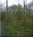
Woodland on Cairn Hill
Looking through woodland towards the summit of Cairn Hill.
Image: © Mark Nightingale
Taken: 14 Apr 2011
0.10 miles
10
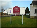
Notice board
At Westerton Parish Church.
Image: © Richard Sutcliffe
Taken: 9 Feb 2023
0.11 miles