IMAGES TAKEN NEAR TO
Dumbarton Road, GLASGOW, G60 5DA

Introduction

This page details the photographs taken nearby to Dumbarton Road, G60 5DA by members of the Geograph project.

The Geograph project started in 2005 with the aim of publishing, organising and preserving representative images for every square kilometre of Great Britain, Ireland and the Isle of Man.

There are currently over 7.5m images from over14,400 individuals and you can help contribute to the project by visiting https://www.geograph.org.uk

Image Map


Images are licensed for reuse under creativecommons.org/licenses/by-sa/2.0
Notes
  • Clicking on the map will re-center to the selected point.
  • The higher the marker number, the further away the image location is from the centre of the postcode.

Image Listing (169 Images Found)

Images are licensed for reuse under creativecommons.org/licenses/by-sa/2.0
  • ...
Image
Details
Distance
1
The Glen Lusset
Bar and restaurant on Dumbarton Road, just beside the Erskine Bridge.
Image: © Richard Sutcliffe Taken: 29 Jul 2018
0.01 miles
2
The Glen Lusset bar
Shown with its relevance to the Erskine Bridge - directly beneath it.
Image: © Stephen Sweeney Taken: 27 Jul 2008
0.01 miles
3
Sign for The Glen Lusset
Sign for the bar and restaurant on Dumbarton Road, Old Kilpatrick [http://www.geograph.org.uk/photo/5860227].
Image: © Richard Sutcliffe Taken: 29 Jul 2018
0.01 miles
4
Old Kilpatrick War Memorial
See Image and Image for views from several years earlier.
Image: © Lairich Rig Taken: 11 Mar 2014
0.02 miles
5
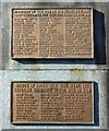
Old Kilpatrick War Memorial: detail
For the whole monument, see Image / Image / Image (At first sight, the present picture might appear to be a composite of two photographs, but it is not. As the pictures at the links given above show, there are two tablets on this side, one above the other, with different surface textures.)
Image: © Lairich Rig Taken: 11 Mar 2014
0.02 miles
6
War Memorial, Old Kilpatrick
'In memory of the men of Old Kilpatrick who gave their lives for King and country 1914-1919' and 'The names of local men who made the supreme sacrifice in the 1939-45 war' [http://www.geograph.org.uk/photo/5860265].
Image: © Richard Sutcliffe Taken: 29 Jul 2018
0.02 miles
7
War Memorial, Old Kilpatrick
Plaques on the war memorial: 'In memory of the men of Old Kilpatrick who gave their lives for King and country 1914-1919' and 'The names of local men who made the supreme sacrifice in the 1939-45 war'.
Image: © Richard Sutcliffe Taken: 29 Jul 2018
0.02 miles
8
Shops beside the Erskine Bridge
Block of shops (Nisa Local and Post Office; The Village Barbers; and The Glen Cafe) with accommodation above, just to the south of the bridge on Dumbarton Road (A814).
Image: © Richard Sutcliffe Taken: 29 Jul 2018
0.03 miles
9
Forth & Clyde Canal
The Erskine Bridge and the Kilpatrick Hills dominate the scene.
Image: © Thomas Nugent Taken: 7 Aug 2010
0.03 miles
10
Old Kilpatrick War Memorial from Erskine Bridge
Image: © Stephen Sweeney Taken: 20 May 2007
0.03 miles
  • ...