
IMAGES TAKEN NEAR TO
Old Rutherglen Road, GLASGOW, G5 9DT
Introduction
This page details the photographs taken nearby to Old Rutherglen Road, G5 9DT by members of the Geograph project.
The Geograph project started in 2005 with the aim of publishing, organising and preserving representative images for every square kilometre of Great Britain, Ireland and the Isle of Man.

There are currently over 7.5m images from over14,400 individuals and you can help contribute to the project by visiting https://www.geograph.org.uk
Image Map
Images are licensed for reuse under creativecommons.org/licenses/by-sa/2.0
Notes
- Clicking on the map will re-center to the selected point.
- The higher the marker number, the further away the image location is from the centre of the postcode.
Image Listing (742 Images Found)
Images are licensed for reuse under creativecommons.org/licenses/by-sa/2.0
Image
Details
Distance
1
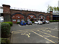
Sharkeys public house
Between Ballater Street and Cleland Lane. Under the City Union railway line, which is a freight and empty stock movements line only which links the lines in the east end of the city with the lines in the south west.
Image: © Thomas Nugent
Taken: 7 May 2016
0.00 miles
2
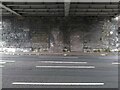
Bricked-up arches
Under the railway bridge over Ballater Street.
Image: © Richard Sutcliffe
Taken: 14 Aug 2021
0.00 miles
3
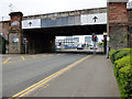
Ballater Street railway bridge
The bridge carries the City Union line, a freight and empty stock movements line only which links the lines in the east end of the city with the lines in the south west.
Image: © Thomas Nugent
Taken: 7 May 2016
0.01 miles
4

Ballater Street railway bridge
The bridge carries the freight and empty stock only City Union Railway line. The Waddel Court towerblocks can be seen in the background.
Image: © Thomas Nugent
Taken: 8 May 2016
0.01 miles
5
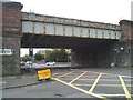
Railway Bridge, Ballater Street
The railway bridge crosses the A8, Ballater Street. The yellow sign points towards the entrance to Glasgow Central Mosque, where there is a Coronavirus (Covid-19) Vaccination Centre.
Image: © Richard Sutcliffe
Taken: 14 Aug 2021
0.01 miles
6
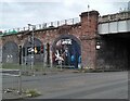
The Gorbals Vampire
Mural on the side of the railway viaduct at the corner of St Luke's Place and Ballater Street. The mural, by Ella Bryson and Art Pistol, commemorates the 'Gorbals Vampire'. There is a summary at the bottom of the mural explaining the story:
'In September 1954 local schoolchildren descended on the Southern Necropolis to hunt down and kill The Man with the Iron Teeth, also known as The Gorbals Vampire.'
Strange, but true! See http://news.bbc.co.uk/1/hi/scotland/8574484.stm.
Image: © Richard Sutcliffe
Taken: 14 Aug 2021
0.01 miles
7
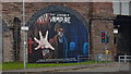
The Gorbals Vampire Artwork
"In September 1954 local schoolchildren descended on the Southern Necropolis to hunt down and kill The Man with the Iron Teeth, also known as The Gorbals Vampire."
http://news.bbc.co.uk/1/hi/scotland/8574484.stm
Image: © Bradley Michael
Taken: 15 Sep 2018
0.01 miles
8

Ballater Street railway bridge
The bridge carries the freight and empty stock only City Union Railway line.
Image: © Thomas Nugent
Taken: 8 May 2016
0.01 miles
9

Ballater Street railway bridge
The bridge and arches carry the freight and empty stock only City Union Railway line.
Image: © Thomas Nugent
Taken: 8 May 2016
0.01 miles
10
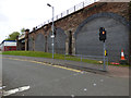
St Lukes Place
Off Ballater Street. The City Union railway line is in the right. This is a freight and empty stock movements line only which links the lines in the east end of the city with the lines in the south west.
Image: © Thomas Nugent
Taken: 7 May 2016
0.02 miles