
IMAGES TAKEN NEAR TO
G5 9BG
Introduction
This page details the photographs taken nearby to G5 9BG by members of the Geograph project.
The Geograph project started in 2005 with the aim of publishing, organising and preserving representative images for every square kilometre of Great Britain, Ireland and the Isle of Man.

There are currently over 7.5m images from over14,400 individuals and you can help contribute to the project by visiting https://www.geograph.org.uk
Image Map
Images are licensed for reuse under creativecommons.org/licenses/by-sa/2.0
Notes
- Clicking on the map will re-center to the selected point.
- The higher the marker number, the further away the image location is from the centre of the postcode.
Image Listing (846 Images Found)
Images are licensed for reuse under creativecommons.org/licenses/by-sa/2.0
Image
Details
Distance
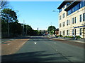
2

Site of Norfolk Court
A few hours after demolition.
See the same scene one day earlier Image
Image: © Thomas Nugent
Taken: 8 May 2016
0.00 miles
3

Site of Norfolk Court
A few hours after demolition.
See the same scene one day earlier Image
Image: © Thomas Nugent
Taken: 8 May 2016
0.00 miles
4
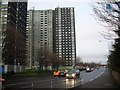
Gorbals high flats
Housing typical of the Gorbals area. The highrise flats were built in the 1960s to improve the area from the derelict tenements previously typical to it, but the area only depreciated further into gang violence in the 1980s.
Image: © Stephen Sweeney
Taken: 17 Dec 2008
0.01 miles
5
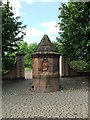
Industrial Monument
What appears to be an industrial monument at the entrance to the rose garden. Three carvings depict local scenes Image, Image and Image
Image: © Thomas Nugent
Taken: 20 Aug 2007
0.02 miles
6
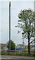
Temporary mobile phone mast
Presumably placed here to replace the masts which will be lost when Norfolk Court gets demolished tomorrow.
See also Image
Image: © Thomas Nugent
Taken: 7 May 2016
0.02 miles
7
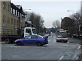
Gorbals Street
At the junction with Norfolk Street and Ballater Street.
Image: © Thomas Nugent
Taken: 13 Feb 2009
0.02 miles
8
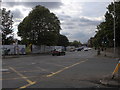
Norfolk Street, Gorbals, Glasgow
The hatched pattern on the road indicates the crossing of Norfolk Street (ahead) and Ballater Street (behind) with Gorbals Street (crossing). Gorbals Street to the right leads to Victoria Bridge across the River Clyde. The plot on the opposite corner is being redeveloped.
Image: © Rudi Winter
Taken: 25 Jun 2019
0.02 miles
9

Site of Norfolk Court
A few hours after demolition of the towerblock. Viewed from Ballater Street.
Image: © Thomas Nugent
Taken: 8 May 2016
0.02 miles
10

Site of Norfolk Court
A few hours after demolition of the towerblock. Viewed from Ballater Street.
Image: © Thomas Nugent
Taken: 8 May 2016
0.02 miles