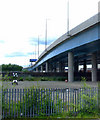
IMAGES TAKEN NEAR TO
West Street, GLASGOW, G5 8LG

Introduction

This page details the photographs taken nearby to West Street, G5 8LG by members of the Geograph project.

The Geograph project started in 2005 with the aim of publishing, organising and preserving representative images for every square kilometre of Great Britain, Ireland and the Isle of Man.

There are currently over 7.5m images from over14,400 individuals and you can help contribute to the project by visiting https://www.geograph.org.uk

Image Map


Images are licensed for reuse under creativecommons.org/licenses/by-sa/2.0
Notes
  • Clicking on the map will re-center to the selected point.
  • The higher the marker number, the further away the image location is from the centre of the postcode.

Image Listing (141 Images Found)

Images are licensed for reuse under creativecommons.org/licenses/by-sa/2.0
  • ...
Image
Details
Distance
1
M74 Northern Extension
Nearing completion, due to open at the end of June 2011. See also Image
Image: © Thomas Nugent Taken: 11 Jun 2011
0.03 miles
2
M74 Northern Extension
Nearing completion, due to open at the end of June 2011.
Image: © Thomas Nugent Taken: 11 Jun 2011
0.04 miles
3
West Street railway bridges
West street has been blocked off just beyond the second bridge and is used as a car park for the subway station which is out of sight to the right of the car.
Image: © Thomas Nugent Taken: 22 Nov 2009
0.05 miles
4
Railway Bridges Over West Street
Low railway bridges over West Street. The road is now used as a car park for the nearby underground station. Despite the amount of shrubbery on the bridge it is still occasionally used by trains.
Image: © Iain Thompson Taken: 22 Aug 2008
0.05 miles
5
Building site
On railway land, south of Glasgow Central, near West Street. Laying the foundations for the M74 northern extension.
Image: © Thomas Nugent Taken: 21 Feb 2009
0.05 miles
6
M74 Junction 1 (Glasgow)
Image: © David Dixon Taken: 24 Mar 2014
0.05 miles
7
M74 Northern Extension
The new elevated section of the M74 through the south side of Glasgow crosses the Glasgow to Paisley railway line at West Street. Viewed from a passing train.
Image: © Thomas Nugent Taken: 3 Oct 2009
0.06 miles
8
Glasgow subway pictorial map
On the exterior wall of West Street station.
Image: © Thomas Nugent Taken: 22 Nov 2009
0.06 miles
9
West Street subway station
Sporting a new colour scheme, with an orange stripe on the Outer Circle and a grey stripe on the Inner Circle.
Image: © Thomas Nugent Taken: 1 Jun 2013
0.06 miles
10
West Street subway station
Inside the barriers at street level.
Image: © Thomas Nugent Taken: 1 Jun 2013
0.06 miles
  • ...