IMAGES TAKEN NEAR TO
Parcville Way, GLASGOW, G53 7WS
Introduction
This page details the photographs taken nearby to Parcville Way, G53 7WS by members of the Geograph project.
The Geograph project started in 2005 with the aim of publishing, organising and preserving representative images for every square kilometre of Great Britain, Ireland and the Isle of Man.

There are currently over 7.5m images from over14,400 individuals and you can help contribute to the project by visiting https://www.geograph.org.uk
Image Map
Images are licensed for reuse under creativecommons.org/licenses/by-sa/2.0
Notes
- Clicking on the map will re-center to the selected point.
- The higher the marker number, the further away the image location is from the centre of the postcode.
Image Listing (44 Images Found)
Images are licensed for reuse under creativecommons.org/licenses/by-sa/2.0
Image
Details
Distance
1
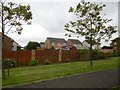
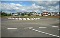
Parkmanor Avenue
Recently built houses.
Image: © Richard Webb
Taken: 28 Aug 2016
0.03 miles
2
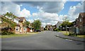
Parkholm Drive
Housing in the Parkhouse Estate.
Image: © Richard Sutcliffe
Taken: 10 Jun 2019
0.03 miles
3
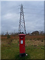
Postbox and Pylon, South Nitshill, Barrhead
Image: © wfmillar
Taken: 14 Mar 2012
0.05 miles
5
Roundabout on Parkhouse Road
An earlier picture shows it from a different angle. In the present picture, Image is to the photographer's right.
See Image for a view back to this point from the other side of the road.
Image: © Lairich Rig
Taken: 26 Aug 2019
0.06 miles
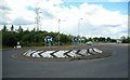
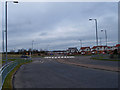
6
Roundabout on the B773
The roundabout on the B773 Parkhouse Road is at the edge of the Parkhouse housing estate.
Image: © Richard Sutcliffe
Taken: 10 Jun 2019
0.06 miles
7
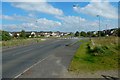
South Nitshill
Looking towards a roundabout on the B773 Parkhouse Road. This area is covered in new housing.
Image: © wfmillar
Taken: 14 Mar 2012
0.06 miles
8
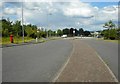
Looking towards the main road
The view from Parkmanor Avenue towards the roundabout on the B773, Parkhouse Road.
Image: © Richard Sutcliffe
Taken: 10 Jun 2019
0.06 miles
9
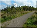
The start of a footpath
As explained at the earlier Image, it leads into Dams to Darnley Country Park. See Image for the signs.
For more context, see Image and Image
Image: © Lairich Rig
Taken: 26 Aug 2019
0.07 miles
10
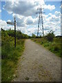
Pylon beside the path
The path leads into Dams to Darnley Country Park. The Country Park is partly in Glasgow and partly in East Renfrewshire.
Image: © Richard Sutcliffe
Taken: 10 Jun 2019
0.07 miles