IMAGES TAKEN NEAR TO
Darnley Mains Road, GLASGOW, G53 7RH
Introduction
This page details the photographs taken nearby to Darnley Mains Road, G53 7RH by members of the Geograph project.
The Geograph project started in 2005 with the aim of publishing, organising and preserving representative images for every square kilometre of Great Britain, Ireland and the Isle of Man.

There are currently over 7.5m images from over14,400 individuals and you can help contribute to the project by visiting https://www.geograph.org.uk
Image Map
Images are licensed for reuse under creativecommons.org/licenses/by-sa/2.0
Notes
- Clicking on the map will re-center to the selected point.
- The higher the marker number, the further away the image location is from the centre of the postcode.
Image Listing (23 Images Found)
Images are licensed for reuse under creativecommons.org/licenses/by-sa/2.0
Image
Details
Distance
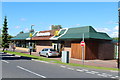
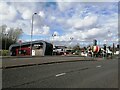
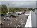
2
Mc Donald's Restaurant on Darnley Mains Road
Image: © JThomas
Taken: 14 Sep 2021
0.02 miles
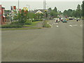
3
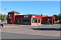
KFC on Nitshill Road
Kentucky Fried Chicken.
Image: © Billy McCrorie
Taken: 3 Sep 2013
0.05 miles
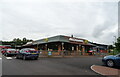
5
Darnley drive-through Costa coffee shop
Image: © Alec MacKinnon
Taken: 13 Apr 2022
0.06 miles
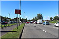
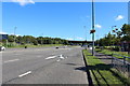
6
Nitshill Road
From the crossing with Glen Moriston Road, at the Darnley Mains retail park.
Image: © Stephen Sweeney
Taken: 25 May 2009
0.06 miles
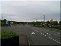
10
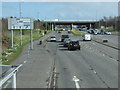
The A726 to East Kilbride
Just west of the M77 bridge.
Image: © Barbara Carr
Taken: 22 Apr 2013
0.10 miles