IMAGES TAKEN NEAR TO
Nitshill Road, GLASGOW, G53 7BT
Introduction
This page details the photographs taken nearby to Nitshill Road, G53 7BT by members of the Geograph project.
The Geograph project started in 2005 with the aim of publishing, organising and preserving representative images for every square kilometre of Great Britain, Ireland and the Isle of Man.

There are currently over 7.5m images from over14,400 individuals and you can help contribute to the project by visiting https://www.geograph.org.uk
Image Map
Images are licensed for reuse under creativecommons.org/licenses/by-sa/2.0
Notes
- Clicking on the map will re-center to the selected point.
- The higher the marker number, the further away the image location is from the centre of the postcode.
Image Listing (123 Images Found)
Images are licensed for reuse under creativecommons.org/licenses/by-sa/2.0
Image
Details
Distance
1
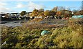
Site of former Bullwood Project
This is the space where the Bullwood Project was previously based. The buildings were extensively damaged by a fire which broke out in the early hours of the morning of 6 September 2018 [http://www.geograph.org.uk/photo/5896966]. The buildings have since been completely demolished and the site cleared.
Image: © Richard Sutcliffe
Taken: 13 Nov 2018
0.01 miles
2
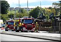
After the fire at Bullwood
A fire broke out in the early hours of the morning of 6 September 2018 at the Bullwood Project on Nitshill Road. The property, which housed the woodturning and firewood charity, was extensively damaged.
As well as re-using trees intended for landfill the charity offers support to people who feel isolated due to ill-health or disability.
Fire crews were clearing up after successfuly extinguishing the fire, and left soon afterwards.
Image: © Richard Sutcliffe
Taken: 6 Sep 2018
0.01 miles
3
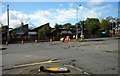
Junction of Nitshill Road and Peat Road
Part of Nitshill Road is temporarily closed, following the fire which broke out in the early hours of the morning of 6 September 2018 at the Bullwood Project on Nitshill Road (behind the cones). The property, which housed the woodturning and firewood charity, was extensively damaged.
Image: © Richard Sutcliffe
Taken: 6 Sep 2018
0.01 miles
4
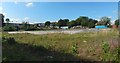
The former site of Bullwood
As a helpful passerby informed me, this was, until about a year before the picture was taken, the site of Bullwood, "a woodturning and woodworking charity", which sold logs and firewood.
It burned down. Another contributor's earlier picture has further information: Image I can only guess that the charity was named after Bull Wood, about 2 km NNW of here at c.Image
Image: © Lairich Rig
Taken: 26 Aug 2019
0.02 miles
5

Surchi Hand Car Wash
On Nitshill Road.
Image: © Richard Sutcliffe
Taken: 7 May 2026
0.03 miles
6
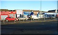
Shops on Nitshill Road
A group of small shops and other premises on the north side of Nitshill Road. Christines is a hairdressers. I suspect there should have been an apostrophe there!
Image: © Richard Sutcliffe
Taken: 15 Dec 2017
0.04 miles
7
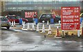
Hand car wash off Nitshill Road
A busy place on a Friday lunchtime - particularly for taxis, which get special rates.
Image: © Richard Sutcliffe
Taken: 15 Dec 2017
0.04 miles
8
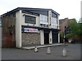
The Cavendish
Public house on Nitshill Road.
Image: © Stephen Sweeney
Taken: 25 May 2009
0.05 miles
9
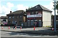
Revolution Tattoo Company
On Peat Road, Nitshill.
Image: © Richard Sutcliffe
Taken: 6 Sep 2018
0.05 miles