IMAGES TAKEN NEAR TO
Brentwood Avenue, GLASGOW, G53 7AD
Introduction
This page details the photographs taken nearby to Brentwood Avenue, G53 7AD by members of the Geograph project.
The Geograph project started in 2005 with the aim of publishing, organising and preserving representative images for every square kilometre of Great Britain, Ireland and the Isle of Man.

There are currently over 7.5m images from over14,400 individuals and you can help contribute to the project by visiting https://www.geograph.org.uk
Image Map
Images are licensed for reuse under creativecommons.org/licenses/by-sa/2.0
Notes
- Clicking on the map will re-center to the selected point.
- The higher the marker number, the further away the image location is from the centre of the postcode.
Image Listing (22 Images Found)
Images are licensed for reuse under creativecommons.org/licenses/by-sa/2.0
Image
Details
Distance
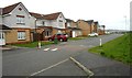
2
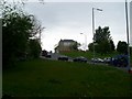
Traffic on Parkhouse Road
Leads to Nitshill and Barrhead.
Image: © Stephen Sweeney
Taken: 25 May 2009
0.15 miles
3
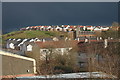
Dark skies over South Nitshill
Storm clouds were gathering to the east, but the houses on Whitehaugh Road were brilliantly illuminated by sunshine.
Image: © Richard Sutcliffe
Taken: 29 Mar 2016
0.17 miles
4
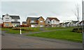
Houses on Woodfoot Quadrant
The house on the left is actually on Whiteacres Road,
Image: © Richard Sutcliffe
Taken: 23 Apr 2018
0.17 miles
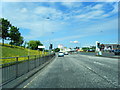
5
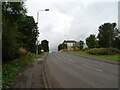
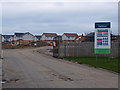
Parkhouse Road (B773)
Heading west towards Barrhead.
Image: © JThomas
Taken: 14 Sep 2021
0.18 miles
6
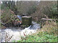
Weir on the Brock Burn
In Darnley Mill Country Park.
Image: © G Laird
Taken: 11 Nov 2013
0.19 miles
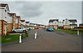
8
Whitehaugh Road
The properties were built in 2001.
Image: © Richard Sutcliffe
Taken: 23 Apr 2018
0.20 miles
10
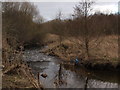
Brock Burn near Darnley Mill
Near Darnley Mill the Brock Burn winds through the trees with many little meanders.
Image: © Alec MacKinnon
Taken: 6 Mar 2016
0.21 miles