
IMAGES TAKEN NEAR TO
Byrebush Road, GLASGOW, G53 5LY
Introduction
This page details the photographs taken nearby to Byrebush Road, G53 5LY by members of the Geograph project.
The Geograph project started in 2005 with the aim of publishing, organising and preserving representative images for every square kilometre of Great Britain, Ireland and the Isle of Man.

There are currently over 7.5m images from over14,400 individuals and you can help contribute to the project by visiting https://www.geograph.org.uk
Image Map
Images are licensed for reuse under creativecommons.org/licenses/by-sa/2.0
Notes
- Clicking on the map will re-center to the selected point.
- The higher the marker number, the further away the image location is from the centre of the postcode.
Image Listing (15 Images Found)
Images are licensed for reuse under creativecommons.org/licenses/by-sa/2.0
Image
Details
Distance
2

St James' (Pollok) Parish Church
Originally built as Titwood Parish Church in 1893, it was dismantled, moved and reassembled here in 1951 https://en.wikipedia.org/wiki/St_James%27_(Pollok)_Parish_Church. It is Category B listed https://portal.historicenvironment.scot/apex/f?p=1505:300:::::VIEWTYPE,VIEWREF:designation,LB33601.
Image: © Richard Sutcliffe
Taken: 25 Sep 2025
0.08 miles
4
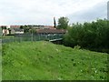
Footbridge over Levern Water
In Pollok, connecting Brockburn Road with Braidcraft Road.
Image: © Stephen Sweeney
Taken: 25 May 2009
0.09 miles
5
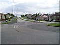
Braidcraft Road, Pollok
Looking east along one of Pollok's main roads from the roundabout at Levernside Road.
Image: © Stephen Sweeney
Taken: 25 May 2009
0.09 miles
6
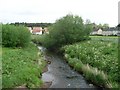
Levern Water
From the footbridge in Pollok.
Image: © Stephen Sweeney
Taken: 25 May 2009
0.09 miles
7
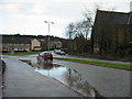
Lyoncross Road, Pollok
This corner always had a puddle when it rained, it may have a drain now.
Image: © Stevie Spiers
Taken: 20 Jan 2005
0.11 miles
8

Lyoncross Road
From beside St James' Church. Meiklerig Crescent is to the right.
Image: © Richard Sutcliffe
Taken: 25 Sep 2025
0.12 miles

10
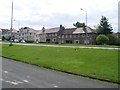
Braidcraft Road
Housing in Pollok.
Image: © Stephen Sweeney
Taken: 25 May 2009
0.14 miles