
IMAGES TAKEN NEAR TO
Braidcraft Road, GLASGOW, G53 5BU
Introduction
This page details the photographs taken nearby to Braidcraft Road, G53 5BU by members of the Geograph project.
The Geograph project started in 2005 with the aim of publishing, organising and preserving representative images for every square kilometre of Great Britain, Ireland and the Isle of Man.

There are currently over 7.5m images from over14,400 individuals and you can help contribute to the project by visiting https://www.geograph.org.uk
Image Map
Images are licensed for reuse under creativecommons.org/licenses/by-sa/2.0
Notes
- Clicking on the map will re-center to the selected point.
- The higher the marker number, the further away the image location is from the centre of the postcode.
Image Listing (51 Images Found)
Images are licensed for reuse under creativecommons.org/licenses/by-sa/2.0
Image
Details
Distance
1
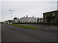
Levernside Road
Looking towards the junction with Langton Road.
Image: © Richard Sutcliffe
Taken: 9 Jul 2015
0.05 miles
2
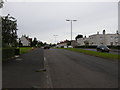
Levernside Road
Just off Braidcroft Road.
Image: © Richard Sutcliffe
Taken: 9 Jul 2015
0.06 miles
3
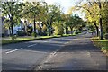
Braidcraft Road
The leaves on the trees are turning yellow as autumn colours start to appear all over Glasgow.
Image: © Richard Sutcliffe
Taken: 13 Oct 2023
0.06 miles
4

Bridge over the Brock Burn
Looking from Waterfoot Avenue across to Southfield Crescent. A stand of giant hogweed is growing beside the burn.
Image: © Richard Sutcliffe
Taken: 25 Sep 2025
0.07 miles
5
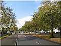
Braidcraft Road, Pollok
One of Pollok's dual carriageways.
Image: © Richard Webb
Taken: 25 Sep 2015
0.07 miles
6

Bridge over the Brock Burn
For pedestrian and cycle use only to cross the burn from Southfield Crescent to Waterfoot Avenue (in the background).
Image: © Richard Sutcliffe
Taken: 25 Sep 2025
0.07 miles
7

Waterfoot Avenue
The tower in the distance is the hose drying tower at Pollok Fire Station.
Image: © Richard Sutcliffe
Taken: 25 Sep 2025
0.08 miles
8

Braidcraft Road, Pollok
As well as the dual carriageway there are local access roads for the houses.
Image: © Richard Webb
Taken: 25 Sep 2015
0.10 miles
9

Barrhead Road
At Pollok Roundabout, with Waterfoot Terrace in the background.
Image: © Thomas Nugent
Taken: 9 Feb 2013
0.12 miles
10
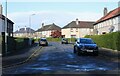
Southfield Crescent
Seen from Braidcraft Road.
Image: © Richard Sutcliffe
Taken: 13 Oct 2023
0.12 miles