IMAGES TAKEN NEAR TO
Rylees Road, GLASGOW, G52 4DB
Introduction
This page details the photographs taken nearby to Rylees Road, G52 4DB by members of the Geograph project.
The Geograph project started in 2005 with the aim of publishing, organising and preserving representative images for every square kilometre of Great Britain, Ireland and the Isle of Man.

There are currently over 7.5m images from over14,400 individuals and you can help contribute to the project by visiting https://www.geograph.org.uk
Image Map (Loading...)


Getting Data...Please wait
Leaflet Map data © OpenStreetMap
Images are licensed for reuse under creativecommons.org/licenses/by-sa/2.0
Notes
- Clicking on the map will re-center to the selected point.
- The higher the marker number, the further away the image location is from the centre of the postcode.
Image Listing (36 Images Found)
Images are licensed for reuse under creativecommons.org/licenses/by-sa/2.0
Image
Details
Distance
1
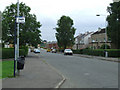
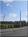
Corse Road
At the junction of Penilee Terrace.
Image: © Thomas Nugent
Taken: 24 Jul 2010
0.16 miles
2
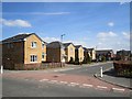
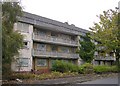
Craigmuir Place
New houses, Penilee. This is a postwar housing development and presumably these are the second generation of houses on the site.
Image: © Richard Webb
Taken: 9 Apr 2013
0.17 miles
3
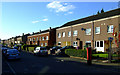
Linburn Road
Looking west. The lane to Hillington West railway station is on the right.
Image: © Thomas Nugent
Taken: 25 Sep 2010
0.17 miles
4
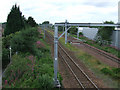
Railway line at Hillington West
Looking west, towards paisley, from Hillington West station footbridge.
Image: © Thomas Nugent
Taken: 24 Jul 2010
0.17 miles
7
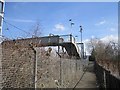
Path to Hillington West Station
On the southern side of the railway which is residential. Over the tracks is the Hillington Industrial Estate.
Image: © Richard Webb
Taken: 9 Apr 2013
0.18 miles
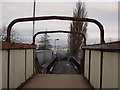
8
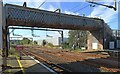
Hillington West railway station
The station footbridge, which is at the west end of the platforms.
Image: © Thomas Nugent
Taken: 14 Sep 2022
0.18 miles
9
Footbridge in Hillington West station
The footbridge connects the two platforms of Hillington West train station. The picture looks north.
Image: © Alec MacKinnon
Taken: 29 Dec 2016
0.18 miles
10

Queen Elizabeth Avenue
At the west end of Hillington Industrial Estate, just off Penilee Road. Atholl Avenue is on the left.
Image: © Thomas Nugent
Taken: 24 Jul 2010
0.19 miles