IMAGES TAKEN NEAR TO
Rylees Crescent, GLASGOW, G52 4BY
Introduction
This page details the photographs taken nearby to Rylees Crescent, G52 4BY by members of the Geograph project.
The Geograph project started in 2005 with the aim of publishing, organising and preserving representative images for every square kilometre of Great Britain, Ireland and the Isle of Man.

There are currently over 7.5m images from over14,400 individuals and you can help contribute to the project by visiting https://www.geograph.org.uk
Image Map
Images are licensed for reuse under creativecommons.org/licenses/by-sa/2.0
Notes
- Clicking on the map will re-center to the selected point.
- The higher the marker number, the further away the image location is from the centre of the postcode.
Image Listing (9 Images Found)
Images are licensed for reuse under creativecommons.org/licenses/by-sa/2.0
Image
Details
Distance
1
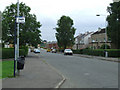
Corse Road
At the junction of Penilee Terrace.
Image: © Thomas Nugent
Taken: 24 Jul 2010
0.09 miles
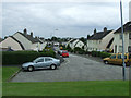
4
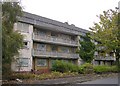
Craigmuir Place
New houses, Penilee. This is a postwar housing development and presumably these are the second generation of houses on the site.
Image: © Richard Webb
Taken: 9 Apr 2013
0.17 miles
5
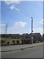
Atholl Crescent
Viewed from the footpath at Penilee Road.
Image: © Thomas Nugent
Taken: 24 Jul 2010
0.21 miles
6
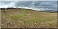
Lower slopes of Honeybog Hill
The highest parts of the hill are in the adjacent grid square to the west. The picture was taken from beside Penilee Road.
Image: © Lairich Rig
Taken: 28 Feb 2014
0.22 miles
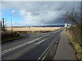
7
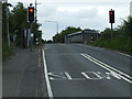
Penilee Road
Viewed from the junction of Arkleston Road. The bridge carries the road over the main Glasgow-Paisley railway line.
Image: © Thomas Nugent
Taken: 24 Jul 2010
0.22 miles
8
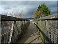
Footbridge over railway line
The footbridge runs along the eastern side of Penilee Road. Only a short distance beyond its far end is the Image
For comparison, see Image, a view back towards the point from which the present picture was taken. The traffic light on the left in that picture is the same one as can be seen from behind in the present view. The picture also shows that the adjacent Penilee Road has no pavement here where it crosses above the railway line.
Image: © Lairich Rig
Taken: 28 Feb 2014
0.23 miles
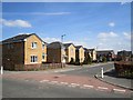
9
Junction of Penilee and Arkleston Road
Penilee Road is in the foreground. For a view in the opposite direction from the same point, see Image
At the centre of the present picture is a small white sign on a pole; just above that sign, the location of some ruins in the field can be made out: they are Image
Image: © Lairich Rig
Taken: 28 Feb 2014
0.25 miles