IMAGES TAKEN NEAR TO
Bogmoor Road, G51 4FH
Introduction
This page details the photographs taken nearby to Bogmoor Road, G51 4FH by members of the Geograph project.
The Geograph project started in 2005 with the aim of publishing, organising and preserving representative images for every square kilometre of Great Britain, Ireland and the Isle of Man.

There are currently over 7.5m images from over14,400 individuals and you can help contribute to the project by visiting https://www.geograph.org.uk
Image Map
Images are licensed for reuse under creativecommons.org/licenses/by-sa/2.0
Notes
- Clicking on the map will re-center to the selected point.
- The higher the marker number, the further away the image location is from the centre of the postcode.
Image Listing (39 Images Found)
Images are licensed for reuse under creativecommons.org/licenses/by-sa/2.0
Image
Details
Distance
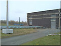
1

Princes Glasgow
On Bogmoor Road. Princes is one of Europe’s largest food and drink groups.
Image: © Richard Sutcliffe
Taken: 26 Apr 2021
0.03 miles
2

Prince's soft drinks factory, Shieldhall
Makers of Jucee and Ocean Spray, among others.
Image: © Stephen Sweeney
Taken: 27 Jul 2008
0.06 miles
3

Renfrew Road
Looking towards Shieldhall Road. The blue building on the left is a Civic Amenity Site.
Image: © Thomas Nugent
Taken: 25 Sep 2010
0.08 miles
4

Renfrew Road
Looking past the Civic Amenity Site to the roundabout at Shieldhall Road.
Image: © Thomas Nugent
Taken: 25 Sep 2010
0.09 miles


7

KGV Dock, Shieldhall
The King George V dock on the South Bank of the Clyde opened in 1931 and is now the only remaining working dock within the Glasgow City boundary. The large dock can accommodate ocean-going ships. Cargoes include animal feeds, grains, chemicals, industrial equipment and, more recently, wind turbines.
Image: © Thomas Nugent
Taken: 29 Aug 2023
0.15 miles
8

Renfrew Road
Looking towards the sharp right turn at the King George V Dock junction.
Image: © Thomas Nugent
Taken: 25 Sep 2010
0.15 miles
9
Shieldhall Waste Water Treatment Station
Viewed from Hardgate Road, it is not possible to see much of the treatment works, as it is hidden by the building on the right. You can smell it more than you can see it! One of the settling tanks is just visible in the distance. Shieldhall is one of four waste water treatment facilities in Glasgow.
Image: © Richard Sutcliffe
Taken: 13 Apr 2021
0.15 miles
10

The ship at the end of the road
Looking down Bogmoor Road towards King George V Dock, where three cruise ships (Azamara Pursuit, Azamara Journey and Azamara Quest) are currently laid-up. They will remain there until the end of the Covid-19 pandemic when business can return to normal.
Image: © Richard Sutcliffe
Taken: 26 Apr 2021
0.16 miles