
IMAGES TAKEN NEAR TO
Napier Place, GLASGOW, G51 2LN
Introduction
This page details the photographs taken nearby to Napier Place, G51 2LN by members of the Geograph project.
The Geograph project started in 2005 with the aim of publishing, organising and preserving representative images for every square kilometre of Great Britain, Ireland and the Isle of Man.

There are currently over 7.5m images from over14,400 individuals and you can help contribute to the project by visiting https://www.geograph.org.uk
Image Map
Images are licensed for reuse under creativecommons.org/licenses/by-sa/2.0
Notes
- Clicking on the map will re-center to the selected point.
- The higher the marker number, the further away the image location is from the centre of the postcode.
Image Listing (597 Images Found)
Images are licensed for reuse under creativecommons.org/licenses/by-sa/2.0
Image
Details
Distance
1
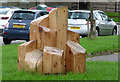
Honeycombs sculpture, Govan Riverside
Honeycombs is by Govan-based artist ts Beall. Several trees were felled during landscaping work at Govan Riverside – some of these trees were salvaged and sawn in hexagonal sections by the GalGael Trust under ts Beall’s direction. These sections were bolted together, carved and sealed. There are five Honeycombs sited around Govan Riverside. This one is between Govan Road and Napier Place, opposite Broomloan Road.
See a more distant view here Image
Image: © Thomas Nugent
Taken: 27 Aug 2018
0.03 miles
2
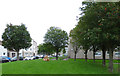
Honeycombs sculpture, Govan Riverside
Honeycombs is by Govan-based artist ts Beall. Several trees were felled during landscaping work at Govan Riverside – some of these trees were salvaged and sawn in hexagonal sections by the GalGael Trust under ts Beall’s direction. These sections were bolted together, carved and sealed. There are five Honeycombs sited around Govan Riverside. This one is between Govan Road and Napier Place, opposite Broomloan Road.
See a closer view here Image
Image: © Thomas Nugent
Taken: 27 Aug 2018
0.03 miles
3
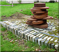
Assembly sculpture at Govan Riverside
"Assembly" consists of three similar sculptures (only one of which is shown here) which mark the extent of the area that is likely to contain the site of Doomster Hill*, the circumference of the circle is that measured by Rev Leishman as the outer edge of Doomster Hill in 1850. A cast bronze plaque records this a probable site of the earthwork. The piled steel recalls that the shipyards were built over Doomster Hill.
By artist Matt Baker http://www.mattbaker.org.uk/ .
* Man-made Doomster Hill was the parliament hill of the kingdom of Strathclyde for 200 years around the year 1000AD.
Image: © Thomas Nugent
Taken: 27 Aug 2018
0.04 miles
4
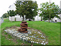
Assembly sculpture at Govan Riverside
"Assembly" consists of three similar sculptures (only one of which is shown here) which mark the extent of the area that is likely to contain the site of Doomster Hill*, the circumference of the circle is that measured by Rev Leishman as the outer edge of Doomster Hill in 1850. A cast bronze plaque records this a probable site of the earthwork. The piled steel recalls that the shipyards were built over Doomster Hill.
By artist Matt Baker http://www.mattbaker.org.uk/ .
* Man-made Doomster Hill was the parliament hill of the kingdom of Strathclyde for 200 years around the year 1000AD.
Image: © Thomas Nugent
Taken: 27 Aug 2018
0.04 miles
5
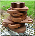
Assembly sculpture at Govan Riverside
"Assembly" consists of three similar sculptures (only one of which is shown here) which mark the extent of the area that is likely to contain the site of Doomster Hill*, the circumference of the circle is that measured by Rev Leishman as the outer edge of Doomster Hill in 1850. A cast bronze plaque records this a probable site of the earthwork. The piled steel recalls that the shipyards were built over Doomster Hill.
By artist Matt Baker http://www.mattbaker.org.uk/ .
* Man-made Doomster Hill was the parliament hill of the kingdom of Strathclyde for 200 years around the year 1000AD.
Image: © Thomas Nugent
Taken: 27 Aug 2018
0.04 miles
6
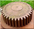
Assembly sculpture at Govan Riverside
"Assembly" consists of three similar sculptures (only one of which is shown here) which mark the extent of the area that is likely to contain the site of Doomster Hill*, the circumference of the circle is that measured by Rev Leishman as the outer edge of Doomster Hill in 1850. A cast bronze plaque records this a probable site of the earthwork. The piled steel recalls that the shipyards were built over Doomster Hill.
The cog on the top, which bears the inscription "the birthplace of my nation is wherever stand is".
By artist Matt Baker http://www.mattbaker.org.uk/ .
* Man-made Doomster Hill was the parliament hill of the kingdom of Strathclyde for 200 years around the year 1000AD.
Image: © Thomas Nugent
Taken: 27 Aug 2018
0.04 miles
7
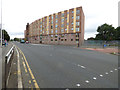
Govan Road
A modern building at the junction with Golspie Street.
Image: © Thomas Nugent
Taken: 27 Aug 2018
0.05 miles
8
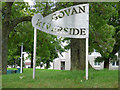
Govan Riverside sign
On Govan Road at Napier Road. Govan Riverside is a housing estate by the River Clyde.
Image: © Thomas Nugent
Taken: 27 Aug 2018
0.05 miles
9
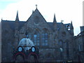
New Govan Church and Aitken Memorial Fountain
Built in 1873 it was originally named St. Mary's Free Church. The domed cast iron fountain was erected in 1884 as a tribute to Dr John Aitken a former medical officer of the parish.
Image: © Lynn M Reid
Taken: 22 Mar 2008
0.05 miles
10

Door of former bank
Door in the Category B listed building http://portal.historicenvironment.scot/designation/LB33342 former Govan Savings Bank by Eric A Sutherland, 1906-7.
Image: © Richard Sutcliffe
Taken: 3 May 2022
0.05 miles