IMAGES TAKEN NEAR TO
Lendel Place, GLASGOW, G51 1BH
Introduction
This page details the photographs taken nearby to Lendel Place, G51 1BH by members of the Geograph project.
The Geograph project started in 2005 with the aim of publishing, organising and preserving representative images for every square kilometre of Great Britain, Ireland and the Isle of Man.

There are currently over 7.5m images from over14,400 individuals and you can help contribute to the project by visiting https://www.geograph.org.uk
Image Map
Images are licensed for reuse under creativecommons.org/licenses/by-sa/2.0
Notes
- Clicking on the map will re-center to the selected point.
- The higher the marker number, the further away the image location is from the centre of the postcode.
Image Listing (187 Images Found)
Images are licensed for reuse under creativecommons.org/licenses/by-sa/2.0
Image
Details
Distance
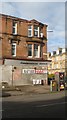
1
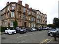
Lendel Place
On the north side of Paisley Road West.
Image: © Thomas Nugent
Taken: 27 Aug 2018
0.01 miles
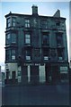
2
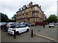
Lendel Place
On the north side of Paisley Road West.
Image: © Thomas Nugent
Taken: 27 Aug 2018
0.02 miles
4
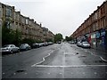
Paisley Road West
Looking east towards Glasgow.
Image: © Stephen Sweeney
Taken: 3 Aug 2008
0.04 miles
5
Langshot Street
Corner of Langshot Street and Paisley Road West.
Image: © Richard Webb
Taken: 6 Mar 2010
0.04 miles
6
Before demolition
An isolated tenement block on Paisley Road West photographed on Christmas day 1975. The pawnbrokers and the pub seem still to be alive, but the rest is abandoned, awaiting arrival of the demolition men clearing the way for redevelopment.
Image: © James Allan
Taken: 25 Dec 1975
0.04 miles
8
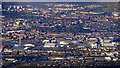
West Glasgow from the air
The prominent riverside structures from left to right are the Glasgow Tower, Glasgow Science Centre, BBC Scotland HQ, Crowne Plaza Hotel, SEC, Armadillo (Clyde Auditorium), Hydro Arena and the Squinty Bridge (Clyde Arc). Kelvingrove Park is in the centre, Glasgow University with its tower on Gilmorehill can be seen to the left of the park. Part of Firhill Stadium can be seen in the top right corner.
The photo was taken from a Prague bound flight from Glasgow, just south of Eaglesham, around 10 miles from the city centre.
Image: © Thomas Nugent
Taken: 24 Sep 2018
0.04 miles
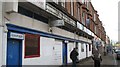
9
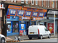
Cessnock Newsagent
I think they sell Irn Bru. On Paisley Road West.
Image: © Thomas Nugent
Taken: 1 Sep 2018
0.04 miles
10
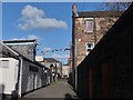
Clifford Lane, Cessnock
Bright bunting marks the entrance to the Psychic Centre in Clifford Lane, which links the mid-points of Percy Street and Langshot Street and runs parallel with Clifford Street.
Image: © Barbara Carr
Taken: 30 Apr 2013
0.05 miles