1
East Glasgow from the air
Glasgow Green, Richmond Park and Shawfield Stadium are in the foreground. Bridgeton Cross is to the left of centre. Celtic Park and the Emirates Arena are at the top, centre. The River Clyde meanders through the scene, as does the M74 motorway.
From left to right, the bridges over the Clyde are St Andrews suspension bridge, King's Bridge, Polmadie Bridge, Rutherglen Bridge, the Smart Bridge (in cloud), Dalmarnock railway bridge, Dalmarnock road bridge and the distant M74 Auchenshuggle Bridge.
Image: © Thomas Nugent
Taken: 1 May 2017
0.02 miles
2
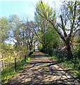
Richmond Park
A shady path at the south side of the ponds.
Image: © Thomas Nugent
Taken: 22 Apr 2022
0.12 miles
3
Demolition of Granton Street, Oatlands
From Old Rutherglen Road.
Image: © Stephen Sweeney
Taken: 18 Feb 2009
0.13 miles
4
Old Oatlands
8 Granton Street,Due to be demolished as part of a regeneration programme.
Image: © Lynn M Reid
Taken: 19 Feb 2008
0.13 miles
5
Broken Stained Glass.
Little window at St Margaret's church Polmadie Road.
Image: © Lynn M Reid
Taken: 24 Mar 2008
0.13 miles
6
No Entry!
8 Granton Street,Oatlands G5. Family once lived in top flat. Soon to be demolished.
Image: © Lynn M Reid
Taken: 19 Feb 2008
0.13 miles
7
Oatlands housing development
New houses are being built in this area beside the M74.
Image: © Alec MacKinnon
Taken: 21 Jan 2017
0.14 miles
8
110 Polmadie Road
Stonework at St. Margaret's church
Image: © Lynn M Reid
Taken: 24 Mar 2008
0.14 miles
9
Old and new together in Oatlands
Granton Street being demolished to make way for a brand new housing estate.
Image: © Stephen Sweeney
Taken: 18 Feb 2009
0.14 miles
10
St. Margaret's Church, Polmadie Road.
It was in this church that my parents married. Me and my brother were also christened here. plans are proposed to convert it to a community centre for the regenerated Oatlands area.
Image: © Lynn M Reid
Taken: 24 Mar 2008
0.15 miles


