
IMAGES TAKEN NEAR TO
Montague Street, GLASGOW, G4 9EY
Introduction
This page details the photographs taken nearby to Montague Street, G4 9EY by members of the Geograph project.
The Geograph project started in 2005 with the aim of publishing, organising and preserving representative images for every square kilometre of Great Britain, Ireland and the Isle of Man.

There are currently over 7.5m images from over14,400 individuals and you can help contribute to the project by visiting https://www.geograph.org.uk
Image Map
Images are licensed for reuse under creativecommons.org/licenses/by-sa/2.0
Notes
- Clicking on the map will re-center to the selected point.
- The higher the marker number, the further away the image location is from the centre of the postcode.
Image Listing (303 Images Found)
Images are licensed for reuse under creativecommons.org/licenses/by-sa/2.0
Image
Details
Distance
2
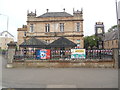
The Old Schoolhouse Pub, Glasgow
Located at 311 Woodlands Road G3 6NG, this pub was formerly Woodside School. It now provides food and drink daily. The pub sign showing a mortarboard and six books can be seen to the right of the photo.
Image: © David Hillas
Taken: 26 Jun 2019
0.05 miles
3
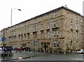
78 - 104 Park Road, Glasgow
4-storey tenement block of 1890, Egyptian-style detailing to the doorways, Listed Category C http://portal.historicenvironment.scot/designation/LB32244
Image: © Alan Murray-Rust
Taken: 24 Jun 2019
0.05 miles
4
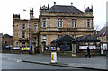
The Old Schoolhouse
The former Woodlands School on Woodside Road, now a pub.
Image: © Thomas Nugent
Taken: 8 Dec 2012
0.06 miles
5
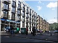
New apartment block on Montague Street
Image: © Roger Cornfoot
Taken: 5 Jun 2015
0.07 miles
6
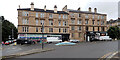
The junction of Eldon Street and Woodlands Road, Glasgow
Image: © habiloid
Taken: 16 Aug 2022
0.07 miles
7
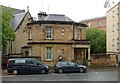
30 Eldon Street, Glasgow
Former janitor's house to Woodside Public School, by Robert Dalglish, dated 1882. Listed Category B http://portal.historicenvironment.scot/designation/LB48025 . The flats just visible to the right have been built on the former school playground. The school itself https://www.geograph.org.uk/photo/3266716 is now a pub.
Image: © Alan Murray-Rust
Taken: 24 Jun 2019
0.07 miles
8
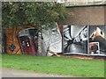
Mural, Kelvingrove Park. 1 - Subway
The northernmost part of a long mural on a transport theme.
Image: © Richard Webb
Taken: 26 Sep 2009
0.07 miles
9
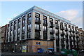
New block of flats at the junction of Montague Street and Great Western Road
New block of flats at the junction of Montague Street and Great Western Road
Image: © Garry Cornes
Taken: 11 May 2015
0.08 miles
10
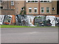
Mural behind Park Road
Organised by Glasgow City Council and several other worthy bodies.
Image: © Keith Edkins
Taken: 10 Jun 2011
0.08 miles