IMAGES TAKEN NEAR TO
Harport Street, GLASGOW, G46 8HD
Introduction
This page details the photographs taken nearby to Harport Street, G46 8HD by members of the Geograph project.
The Geograph project started in 2005 with the aim of publishing, organising and preserving representative images for every square kilometre of Great Britain, Ireland and the Isle of Man.

There are currently over 7.5m images from over14,400 individuals and you can help contribute to the project by visiting https://www.geograph.org.uk
Image Map
Images are licensed for reuse under creativecommons.org/licenses/by-sa/2.0
Notes
- Clicking on the map will re-center to the selected point.
- The higher the marker number, the further away the image location is from the centre of the postcode.
Image Listing (38 Images Found)
Images are licensed for reuse under creativecommons.org/licenses/by-sa/2.0
Image
Details
Distance
1
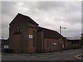
Carnwadric Church
Modern brick place of worship; Church of Scotland.
Image: © Alec MacKinnon
Taken: 1 Jul 2017
0.08 miles

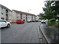
3
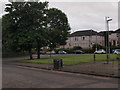
Junction of Kennishead Avenue and Boydstone Road
Image: © Alec MacKinnon
Taken: 1 Jul 2017
0.12 miles
4
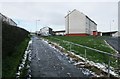
Slippery path, Hopeman Avenue
The footpath runs from Hopeman Drive, on the right, to join Hopeman Avenue.
Image: © Richard Sutcliffe
Taken: 13 Jan 2017
0.14 miles
5
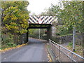
Small Railway Bridge at Kennishead
The bridge is just beside Kennishead railway station. Traffic lights control the passage of traffic under the bridge.
Image: © G Laird
Taken: 30 Oct 2013
0.16 miles
7
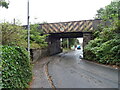
Railway bridge over the Boydstone Road
Near Kennishead Railway Station.
Image: © JThomas
Taken: 14 Sep 2021
0.16 miles

9
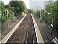
Kennishead railway station, East Renfrewshire
Opened in 1848 by the Glasgow, Barrhead and Neilston Direct Railway, on the line from Glasgow Central to Kilmarnock. View north east towards Pollokshaws West and Glasgow.
Image: © Nigel Thompson
Taken: 12 Oct 2013
0.16 miles
10
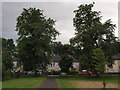
Path in King George V Park
Here the path approaches Boydstone Road, leaving the park near a wee group of shops and fast food takeaways.
Image: © Alec MacKinnon
Taken: 1 Jul 2017
0.16 miles