
IMAGES TAKEN NEAR TO
Heathwood Drive, GLASGOW, G46 7BT
Introduction
This page details the photographs taken nearby to Heathwood Drive, G46 7BT by members of the Geograph project.
The Geograph project started in 2005 with the aim of publishing, organising and preserving representative images for every square kilometre of Great Britain, Ireland and the Isle of Man.

There are currently over 7.5m images from over14,400 individuals and you can help contribute to the project by visiting https://www.geograph.org.uk
Image Map
Images are licensed for reuse under creativecommons.org/licenses/by-sa/2.0
Notes
- Clicking on the map will re-center to the selected point.
- The higher the marker number, the further away the image location is from the centre of the postcode.
Image Listing (12 Images Found)
Images are licensed for reuse under creativecommons.org/licenses/by-sa/2.0
Image
Details
Distance
1

Woodfarm sports pitches
By the High School and Our Lady of the Missions primary.
Image: © Richard Webb
Taken: 28 Sep 2025
0.14 miles

3

Cricket pitch, Woodfarm Playing Fields
Image: © Richard Webb
Taken: 28 Sep 2025
0.16 miles
4

Westfield Road, Thornliebank
Overlooking Woodfarm High School, right.
Image: © Richard Webb
Taken: 28 Sep 2025
0.18 miles
5
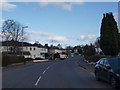
Looking along Orchard Park Avenue
The main thoroughfare connecting Giffnock to Thornliebank, this road is usually busy in non-lockdown times. We look east towards Giffnock from near its lowest point.
Image: © Alec MacKinnon
Taken: 28 Mar 2020
0.21 miles
6

Path, Woodfarm
A way through the complicated multi school campus.
Image: © Richard Webb
Taken: 28 Sep 2025
0.21 miles
7
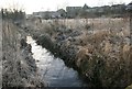
The Auldhouse Burn
Looking south from the concrete bridge.
Photographed on a frosty January day.
Image: © Richard Sutcliffe
Taken: 5 Jan 2017
0.21 miles
8

Our Lady of the Missions Primary School
On a large shared campus. between St Ninian's High School and Woodfarm High School. Taken from near the site of Wood, a long demolished farm.
Image: © Richard Webb
Taken: 28 Sep 2025
0.21 miles
9
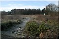
Open ground south of the railway
An area of open ground between a railway line to the north, Robslee Drive to the east, Thornliebank Resource Centre and houses to the south, and Eastwood New Cemetery (amongst the trees) to the west. The Auldhouse Burn cuts across the middle.
Photographed on a frosty January day.
Image: © Richard Sutcliffe
Taken: 5 Jan 2017
0.22 miles
10

Bridge over the Auldhouse Burn
Simple concrete bridge crossing the Auldhouse Burn. Looking towards houses on Groveburn Avenue and the corner of Eastwood New Cemetery (in the trees).
Photographed on a frosty January day.
Image: © Richard Sutcliffe
Taken: 5 Jan 2017
0.24 miles