
IMAGES TAKEN NEAR TO
Cressland Drive, GLASGOW, G45 9HR
Introduction
This page details the photographs taken nearby to Cressland Drive, G45 9HR by members of the Geograph project.
The Geograph project started in 2005 with the aim of publishing, organising and preserving representative images for every square kilometre of Great Britain, Ireland and the Isle of Man.

There are currently over 7.5m images from over14,400 individuals and you can help contribute to the project by visiting https://www.geograph.org.uk
Image Map
Images are licensed for reuse under creativecommons.org/licenses/by-sa/2.0
Notes
- Clicking on the map will re-center to the selected point.
- The higher the marker number, the further away the image location is from the centre of the postcode.
Image Listing (8 Images Found)
Images are licensed for reuse under creativecommons.org/licenses/by-sa/2.0
Image
Details
Distance
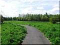
2
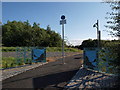
Entrance to Cathkin Braes Country Park
A path for cyclists and pedestrians leaves Ardencraig Road here, going to Cathkin Braes or to the village of Carmunnock.
Image: © Alec MacKinnon
Taken: 6 Sep 2015
0.12 miles
3
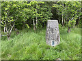
Windlaw Trig Point Flush Bracket S3677
Image: © thejackrustles
Taken: 15 May 2022
0.15 miles
4
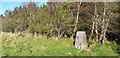
Cathkin Braes trig point
A trig point in Cathkin Braes Country Park.
Image: © Colin Kinnear
Taken: 26 Sep 2020
0.16 miles
5
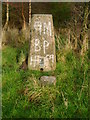
Trig point daubed in graffiti
Ordnance Survey icon treated with disrespect.
Image: © Mark Nightingale
Taken: 3 Dec 2009
0.17 miles
6
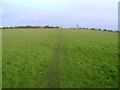
Diagonal path
This path cuts diagonally across the fallow field pictured, ignoring the trig point at the top of the field.
Image: © Mark Nightingale
Taken: 3 Dec 2009
0.24 miles
8
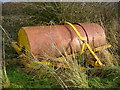
Disused roller
This roller appears to have fallen into disuse and has thus adopted a fetching rusty hue.
Image: © Mark Nightingale
Taken: 3 Dec 2009
0.25 miles