IMAGES TAKEN NEAR TO
Carmunnock Road, GLASGOW, G44 5AG
Introduction
This page details the photographs taken nearby to Carmunnock Road, G44 5AG by members of the Geograph project.
The Geograph project started in 2005 with the aim of publishing, organising and preserving representative images for every square kilometre of Great Britain, Ireland and the Isle of Man.

There are currently over 7.5m images from over14,400 individuals and you can help contribute to the project by visiting https://www.geograph.org.uk
Image Map
Images are licensed for reuse under creativecommons.org/licenses/by-sa/2.0
Notes
- Clicking on the map will re-center to the selected point.
- The higher the marker number, the further away the image location is from the centre of the postcode.
Image Listing (16 Images Found)
Images are licensed for reuse under creativecommons.org/licenses/by-sa/2.0
Image
Details
Distance
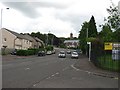
1
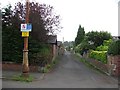
Carmunnock Lane
Narrow road serving the rear of houses on Carmunnock Road.
Image: © Richard Webb
Taken: 29 Jun 2011
0.02 miles
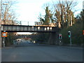
2
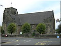
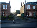
Cathcart Old Parish Church, Carmunnock Road, Glasgow
Image: © Iain Thompson
Taken: 4 Oct 2005
0.05 miles
4
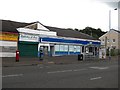
Scotmid, Aikinhead Road
Co-op on Aikinhead Road, King's Park.
Image: © Richard Webb
Taken: 29 Jun 2011
0.15 miles
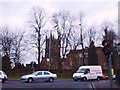
7
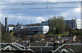
Kings Park Secondary School
Viewed from Cathcart railway station.
Image: © Thomas Nugent
Taken: 27 Apr 2013
0.20 miles
8
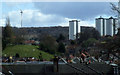
Castlemilk towerblocks
With the new wind turbine on the distant Cathkin Braes managing to make them look quite small. Viewed from Cathcart railway station.
Image: © Thomas Nugent
Taken: 27 Apr 2013
0.20 miles
9
Lane between houses on King's Park Avenue
Leads to a longer lane beside the railway line.
Image: © Stephen Sweeney
Taken: 28 Jan 2009
0.21 miles
10
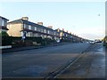
King's Park Avenue
Main road through the King's Park area of Glasgow.
Image: © Stephen Sweeney
Taken: 28 Jan 2009
0.22 miles