IMAGES TAKEN NEAR TO
Courthill Avenue, GLASGOW, G44 5AA
Introduction
This page details the photographs taken nearby to Courthill Avenue, G44 5AA by members of the Geograph project.
The Geograph project started in 2005 with the aim of publishing, organising and preserving representative images for every square kilometre of Great Britain, Ireland and the Isle of Man.

There are currently over 7.5m images from over14,400 individuals and you can help contribute to the project by visiting https://www.geograph.org.uk
Image Map
Images are licensed for reuse under creativecommons.org/licenses/by-sa/2.0
Notes
- Clicking on the map will re-center to the selected point.
- The higher the marker number, the further away the image location is from the centre of the postcode.
Image Listing (19 Images Found)
Images are licensed for reuse under creativecommons.org/licenses/by-sa/2.0
Image
Details
Distance
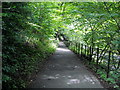
1
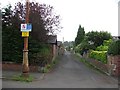
Carmunnock Lane
Narrow road serving the rear of houses on Carmunnock Road.
Image: © Richard Webb
Taken: 29 Jun 2011
0.13 miles
2
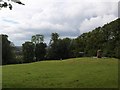
Court Knowe monument
The Battle of Langside on 12 May 1568 is commemorated in the Battlefield monument (Image). Mary Queen of Scots did not, of course, take part in the battle personally, but watched the defeat of her supporters from a nearby eminence, believed to be here on Court Knowe. The monument commemorates the unfortunate monarch's presence on that day.
Image: © Alec MacKinnon
Taken: 19 Jun 2011
0.14 miles
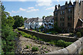
4
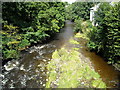
Flood protection work
The concrete wall is being built to protect the houses to the right from flooding by this small river. These houses have flooded previously and the defences are really overdue.
Image: © Malcolm Neal
Taken: 23 Aug 2018
0.17 miles
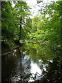
8
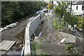
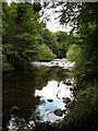
From the Snuff Mill Bridge
The view shows the completed flood defences with the river at its lowest. When in flood it reaches just below the top of the flood prevention wall.
Image: © Malcolm Neal
Taken: 29 Jun 2021
0.19 miles
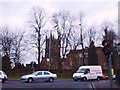
10
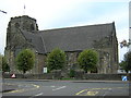
Cathcart Old Parish Church, Carmunnock Road, Glasgow
Image: © Iain Thompson
Taken: 4 Oct 2005
0.20 miles