
IMAGES TAKEN NEAR TO
St. Andrews Crescent, GLASGOW, G41 5SQ
Introduction
This page details the photographs taken nearby to St. Andrews Crescent, G41 5SQ by members of the Geograph project.
The Geograph project started in 2005 with the aim of publishing, organising and preserving representative images for every square kilometre of Great Britain, Ireland and the Isle of Man.

There are currently over 7.5m images from over14,400 individuals and you can help contribute to the project by visiting https://www.geograph.org.uk
Image Map
Images are licensed for reuse under creativecommons.org/licenses/by-sa/2.0
Notes
- Clicking on the map will re-center to the selected point.
- The higher the marker number, the further away the image location is from the centre of the postcode.
Image Listing (85 Images Found)
Images are licensed for reuse under creativecommons.org/licenses/by-sa/2.0
Image
Details
Distance
3
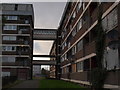
Flats beside St Andrews Drive
This picture shows the "back" of the flats, the side away from the main thoroughfare of St Andrews Drive.
Image: © Alec MacKinnon
Taken: 22 Oct 2017
0.05 miles
4

Modern apartments on Shields Road
More traditional tenements beyond junction
Image: © Jim Smillie
Taken: 14 Jul 2022
0.05 miles
5

Shields Road
Looking south from the railway bridges.
Image: © Thomas Nugent
Taken: 2 Oct 2009
0.05 miles
6

Shields depot
The east end of the depot. See also Image
Image: © Thomas Nugent
Taken: 8 Sep 2008
0.05 miles
7

Shields Road
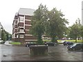
New flats near the junction with St Andrews Drive.
Image: © Thomas Nugent
Taken: 2 Oct 2009
0.06 miles
8

St Andrews Crescent
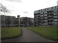
Attractive grounds surround these renovated flats, viewed from St Andrews Drive.
Image: © Thomas Nugent
Taken: 2 Oct 2009
0.07 miles
9

Shields Road
Looking south from the railway bridges.
Image: © Thomas Nugent
Taken: 2 Oct 2009
0.07 miles
10
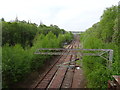
Shields Road railway station (site), Glasgow
Opened in 1870 by the City of Glasgow Union Railway on the line from Glasgow St. Enoch to Paisley etc, this station closed in 1966 and was demolished.
View west towards Ibrox and Paisley. It was immediately adjacent to Shields station to the south (left) and Pollokshields station to the north (right) and in 1925, the three stations were amalgamated under the name "Shields Road".
Image: © Nigel Thompson
Taken: 29 Apr 2019
0.08 miles