IMAGES TAKEN NEAR TO
Mariscat Road, GLASGOW, G41 4NJ
Introduction
This page details the photographs taken nearby to Mariscat Road, G41 4NJ by members of the Geograph project.
The Geograph project started in 2005 with the aim of publishing, organising and preserving representative images for every square kilometre of Great Britain, Ireland and the Isle of Man.

There are currently over 7.5m images from over14,400 individuals and you can help contribute to the project by visiting https://www.geograph.org.uk
Image Map
Images are licensed for reuse under creativecommons.org/licenses/by-sa/2.0
Notes
- Clicking on the map will re-center to the selected point.
- The higher the marker number, the further away the image location is from the centre of the postcode.
Image Listing (62 Images Found)
Images are licensed for reuse under creativecommons.org/licenses/by-sa/2.0
Image
Details
Distance
1
Darnley Gardens
Viewed from Shields Road railway bridge.
Image: © Thomas Nugent
Taken: 6 Jan 2010
0.02 miles
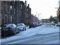
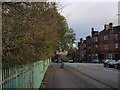
2
Fotheringay Road
South of the railway at Shields Road. Darnley Gardens is to the left.
Image: © Thomas Nugent
Taken: 6 Jan 2010
0.04 miles
3
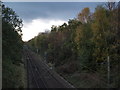
Railway line between Pollokshields West and Maxwell Park stations
The picture is taken from the bridge over the railway on Shields Road, looking west.
Image: © Alec MacKinnon
Taken: 22 Oct 2017
0.04 miles
4
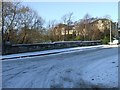
Shields Road
The railway bridge over the Cathcart Circle line at Pollokshields West station.
Image: © Thomas Nugent
Taken: 6 Jan 2010
0.07 miles
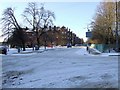
6
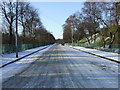
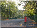
Terregles Avenue
A long, broad and straight avenue. Titwoor Park is to the right.
Image: © Thomas Nugent
Taken: 6 Jan 2010
0.07 miles
7
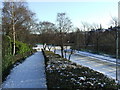
Entrance to Titwood Park
Looking down the east entrance to the junction of Terregles Avenue and Shields Road.
Image: © Thomas Nugent
Taken: 6 Jan 2010
0.07 miles
8
Titwood Park
The Leslie Road entrance to the park, viewed from Terregles Avenue.
Image: © Thomas Nugent
Taken: 6 Jan 2010
0.08 miles
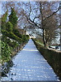
9
Fotheringay Road at Darnley Gardens
The railing at left fences off the railway line.
Image: © Alec MacKinnon
Taken: 22 Oct 2017
0.08 miles
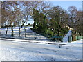
10
Entrance to Titwood Park
The steep west entrance from Terregles Avenue at Leslie Road.
Image: © Thomas Nugent
Taken: 6 Jan 2010
0.09 miles