
IMAGES TAKEN NEAR TO
Cowcaddens Road, GLASGOW, G4 0HL
Introduction
This page details the photographs taken nearby to Cowcaddens Road, G4 0HL by members of the Geograph project.
The Geograph project started in 2005 with the aim of publishing, organising and preserving representative images for every square kilometre of Great Britain, Ireland and the Isle of Man.

There are currently over 7.5m images from over14,400 individuals and you can help contribute to the project by visiting https://www.geograph.org.uk
Image Map
Images are licensed for reuse under creativecommons.org/licenses/by-sa/2.0
Notes
- Clicking on the map will re-center to the selected point.
- The higher the marker number, the further away the image location is from the centre of the postcode.
Image Listing (863 Images Found)
Images are licensed for reuse under creativecommons.org/licenses/by-sa/2.0
Image
Details
Distance
1
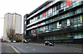
Cowcaddens Road
Looking towards Dundasvale Court.
Image: © Thomas Nugent
Taken: 6 Jan 2013
0.01 miles
2
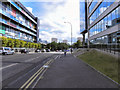
Cowcaddens Road
Looking east, along Cowcaddens Road, from the corner of Hope Street.
Image: © David Dixon
Taken: 19 Aug 2010
0.02 miles
3
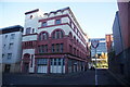
Orient Buildings on McPhaters Street, Glasgow
Image: © Ian S
Taken: 12 Nov 2023
0.02 miles
4
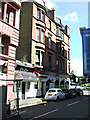
McPhater Street
Chew Chew sandwich bar and the Station Bar are reminiscent of the days when Buchanan Street railway station stood nearby.
Image: © Thomas Nugent
Taken: 4 Aug 2013
0.02 miles
5

Chew Chew and the Station Bar
On McPhater Street at Port Dundas Road. Reminiscent of the days when Buchanan Street railway station stood nearby.
Image: © Thomas Nugent
Taken: 4 Aug 2013
0.02 miles
6

Orient Buildings
A Category A Listed building http://data.historic-scotland.gov.uk/pls/htmldb/f?p=2200:15:0::::BUILDING:32754 also known as Ozalid's. More information from this http://www.architectureglasgow.co.uk/oldcity.orient.html .
See also Image
Image: © Thomas Nugent
Taken: 4 Aug 2013
0.02 miles
7
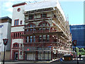
Orient Buildings
A Category A Listed building http://data.historic-scotland.gov.uk/pls/htmldb/f?p=2200:15:0::::BUILDING:32754 also known as Ozalid's. More information from this http://www.architectureglasgow.co.uk/oldcity.orient.html .
See also Image
Image: © Thomas Nugent
Taken: 4 Aug 2013
0.02 miles
8
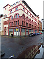
Orient Buildings
A former warehouse on McPhater Street, Category A Listed http://portal.historicenvironment.scot/designation/LB32754 .
See also Image
Image: © Thomas Nugent
Taken: 1 Dec 2018
0.02 miles
9

McPhater Street
The front of the National Piping Centre.
Image: © DS Pugh
Taken: 5 Apr 2019
0.02 miles
10
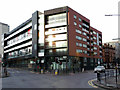
The Matrix
Flats at the corner of Port Dundas Road (on the right) and Cowcaddens Road.
Image: © Thomas Nugent
Taken: 7 Jan 2012
0.03 miles