
IMAGES TAKEN NEAR TO
Overnewton Square, GLASGOW, G3 8RW
Introduction
This page details the photographs taken nearby to Overnewton Square, G3 8RW by members of the Geograph project.
The Geograph project started in 2005 with the aim of publishing, organising and preserving representative images for every square kilometre of Great Britain, Ireland and the Isle of Man.

There are currently over 7.5m images from over14,400 individuals and you can help contribute to the project by visiting https://www.geograph.org.uk
Image Map
Images are licensed for reuse under creativecommons.org/licenses/by-sa/2.0
Notes
- Clicking on the map will re-center to the selected point.
- The higher the marker number, the further away the image location is from the centre of the postcode.
Image Listing (420 Images Found)
Images are licensed for reuse under creativecommons.org/licenses/by-sa/2.0
Image
Details
Distance
1
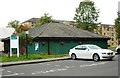
Overnewton Recreation Centre
A fitness centre offering a wide range of exercise and leisure activities in Overnewton Square.
Image: © Richard Sutcliffe
Taken: 16 Aug 2018
0.03 miles
2
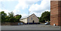
Blackie Street
Viewed from Haugh Road.
See also Image
Image: © Thomas Nugent
Taken: 13 Jul 2018
0.03 miles
3
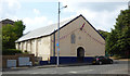
Blackie Street Orange Halls
On Blackie Street at Haugh Road.
Image: © Thomas Nugent
Taken: 13 Jul 2018
0.03 miles
4
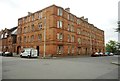
Tenements on Blackie Street
Overnewton Street is to the left.
Image: © Richard Sutcliffe
Taken: 16 Aug 2018
0.05 miles
5
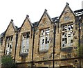
Former Overnewton School
Some of the glass still remains in the windows of the Category B listed school [http://portal.historicenvironment.scot/designation/LB33084] destroyed by a major fire in 2013.
The school closed in 1993, but became the Steiner School in 1994.
There may be plans to restore the building and convert it into residential accommodation.
Image: © Richard Sutcliffe
Taken: 16 Aug 2018
0.05 miles
6
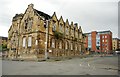
Former Overnewton School
Category B listed school [http://portal.historicenvironment.scot/designation/LB33084]. The school closed in 1993, but became the Steiner School in 1994. A major fire destroyed the building in 2013, leaving it as an empty shell. There may be plans to restore the building and convert it into residential accommodation.
Image: © Richard Sutcliffe
Taken: 16 Aug 2018
0.05 miles
8
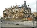
Former Overnewton School
Category B listed school [http://portal.historicenvironment.scot/designation/LB33084]. The school closed in 1993, but became the Steiner School in 1994. A major fire destroyed the building in 2013, leaving it as an empty shell. There may be plans to restore the building and convert it into residential accommodation. The building is surrounded by barriers due to its unsafe condition.
Image: © Richard Sutcliffe
Taken: 16 Aug 2018
0.05 miles
9
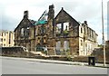
Former Overnewton School
Category B listed school [http://portal.historicenvironment.scot/designation/LB33084]. The school closed in 1993, but became the Steiner School in 1994. A major fire destroyed the building in 2013, leaving it as an empty shell. There may be plans to restore the building and convert it into residential accommodation.
Image: © Richard Sutcliffe
Taken: 16 Aug 2018
0.06 miles
10

Bike For Good
A large charitable bike shop and workshop on Haugh Road.
Web site: https://www.bikeforgood.org.uk/about-us/history-mission/ .
Image: © Thomas Nugent
Taken: 13 Jul 2018
0.06 miles