1
Former Overnewton School
Category B listed school [http://portal.historicenvironment.scot/designation/LB33084]. The school closed in 1993, but became the Steiner School in 1994. A major fire destroyed the building in 2013, leaving it as an empty shell. There may be plans to restore the building and convert it into residential accommodation.
Image: © Richard Sutcliffe
Taken: 16 Aug 2018
0.00 miles
2
Sign for former Steiner School
The former Category B listed Overnewton School became the Steiner School in 1994. A major fire destroyed the building in 2013, leaving it as an empty shell.
Image: © Richard Sutcliffe
Taken: 16 Aug 2018
0.01 miles
3
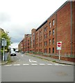
Scaffolded building, Yorkhill Street
Image: © Mark Anderson
Taken: 26 Jun 2019
0.01 miles
4
Former Overnewton School
Category B listed school [http://portal.historicenvironment.scot/designation/LB33084]. The school closed in 1993, but became the Steiner School in 1994. A major fire destroyed the building in 2013, leaving it as an empty shell. There may be plans to restore the building and convert it into residential accommodation. The building is surrounded by barriers due to its unsafe condition.
Image: © Richard Sutcliffe
Taken: 16 Aug 2018
0.01 miles
5
Former Overnewton School
Some of the glass still remains in the windows of the Category B listed school [http://portal.historicenvironment.scot/designation/LB33084] destroyed by a major fire in 2013.
The school closed in 1993, but became the Steiner School in 1994.
There may be plans to restore the building and convert it into residential accommodation.
Image: © Richard Sutcliffe
Taken: 16 Aug 2018
0.02 miles
6
Former Overnewton School
Category B listed school [http://portal.historicenvironment.scot/designation/LB33084]. The school closed in 1993, but became the Steiner School in 1994. A major fire destroyed the building in 2013, leaving it as an empty shell. There may be plans to restore the building and convert it into residential accommodation.
Image: © Richard Sutcliffe
Taken: 16 Aug 2018
0.02 miles
7
Nairn Street, Yorkhill
Image: © Richard Sutcliffe
Taken: 16 Aug 2018
0.05 miles
8
Yorkhill Street
Looking from the junction with Yorkhill Parade.
Image: © Richard Sutcliffe
Taken: 16 Aug 2018
0.05 miles
9
Overnewton Recreation Centre
A fitness centre offering a wide range of exercise and leisure activities in Overnewton Square.
Image: © Richard Sutcliffe
Taken: 16 Aug 2018
0.08 miles
10
The sign above the door refers to the 6th Battalion, Highland Light Infantry
See http://www.geograph.org.uk/photo/4156608 for the complete building
Image: © Elliott Simpson
Taken: 27 Aug 2014
0.08 miles


